
Our beautiful national parks are known for their scenic park roads and hiking trails, but they’re not in general much of a draw for off-road enthusiasts.
There are some exceptions, though, and coming up are some of the best, ranging from routes almost any car can handle to ones that require high clearance and/or 4-wheel drive.
The Racetrack– Death Valley, California
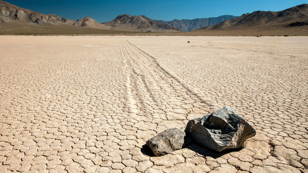
Image Credit: Vezzani Photography/Shutterstock.
Death Valley has hundreds of miles of unpaved road. One of the best destinations these unpaved roads get you to is Racetrack Valley, where there is a playa (dry lake bed) famous for the “moving rocks” at its southern end, giving the place its name. Go see the “tracks” left by the moving rocks and try to figure out how they occur before you look up the answer, which took geologists a long time to figure out. The best route starts from pavement’s end at Ubehebe Crater, and high clearance is recommended, but I’ve made the drive in a sedan before.
Eureka Dunes– Death Valley, California
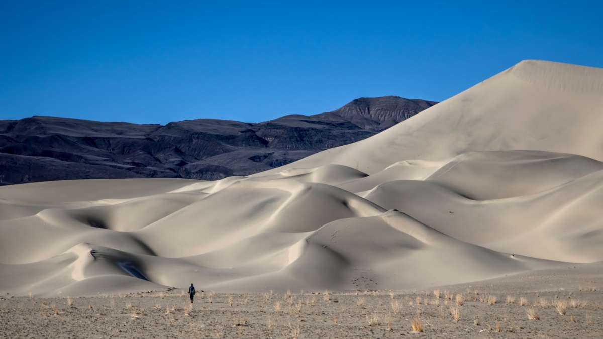
Image Credit: Michael Andrew Just/Shutterstock.
The remote Eureka Valley sand dunes are among the highest in North America. It’s easiest to get there via Big Pine Road in the northern section of the park and then head south on the road to Eureka Valley. This is another one marked as a high-clearance road but which can be handled by most passenger cars.
Saline Valley Dunes– Death Valley, California
Image Credit: Sneaky Buddy/Shutterstock.
Along the western edge of the park, sometimes cutting out and then back in, is the Saline Valley Road, and about halfway along it are the Saline Valley Dunes, which aren’t that high but are remote and infrequently visited. High clearance is a good idea for this trip, especially if you’re coming from the northern end, which has rougher conditions.
North Fork Road– Glacier, Montana
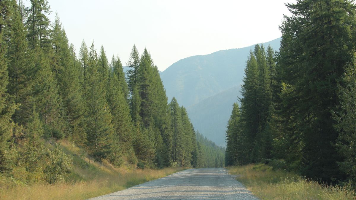
Image Credit: KPV89/Shutterstock.
There are two starts for this, both beginning at Apgar near the western boundary of the park. Both converge at Polebridge, where there’s a ranger station. This section of the park is heavily forested and the elevation isn’t very high, so views aren’t that great, but the drive gets you to Bowman Lake and Kintla Lake, where there are small campgrounds and excellent mountain views.
Sage Creek Basin– Badlands, South Dakota
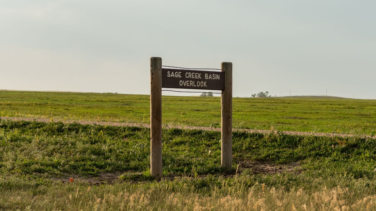
Image Credit: Kelly vanDellen/Shutterstock.
Near the eastern entrance station for the North Unit (the main area most people visit), a dirt road heads out and down to Sage Creek Basin. This area is more rolling and prairie-like than the areas the main park road takes you through. There are no official trails there, but it’s nice to just get out and wander, maybe following a dry wash to see where it goes, and make sure to give bison plenty of space! Unless this road is wet, it’s fine for regular cars.
Sheep Mountain Table– Badlands, South Dakota
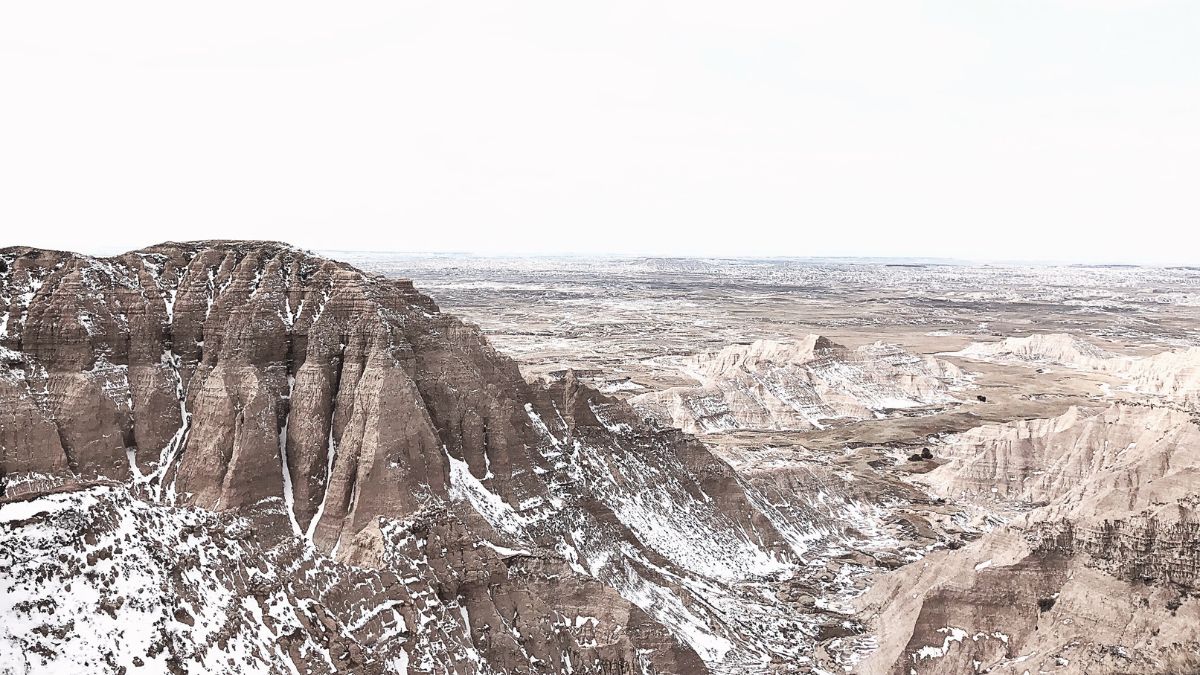
Image Credit: Ben Lawrence/Shutterstock.
The Sage Creek Road continues out of the park and ends at SR 44. Make a right and then a left to get to the Stronghold Unit of the national park, which is within the Pine Ridge Indian Reservation. Watch for the turnoff for Sheep Mountain Table, a high-clearance road that climbs to the top of a mesa with incredible views of nearby badlands landscapes. It’s also a great place to spend a quiet night in the wilderness.
Old Fall River Road– Rocky Mountain, Colorado

Image Credit:Tricia Daniel/Shutterstock.
Passable to most vehicles, Old Fall River Road climbs from wooded valleys into the alpine heights. It eventually joins Trail Ridge Road at the Alpine Visitor Center. Old Fall River Road is one-way only, and Trail Ridge Road will get you back to your starting point or take you west and then south to exit the park.
Cathedral Valley– Capitol Reef, Utah
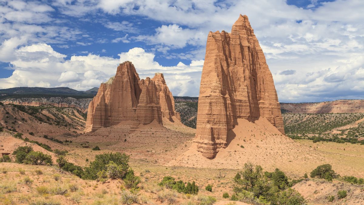
Image Credit: Guoqiang Xue/Shutterstock.
Cathedral Valley is a remote, stunningly beautiful area of huge sandstone monoliths in the northern section of Capitol Reef National Park. The full loop, which is about 60 miles, requires high clearance and preferably 4-wheel drive as well due to steep grades and a river crossing (test the depth before crossing, especially in spring when snowmelt can make water levels too high), but with a passenger vehicle, you can still get through some colorful badlands all the way to Lower Cathedral Valley, where you’ll marvel at the Temple of the Sun and Temple of the Moon and also get to check out a gypsum outcrop called Glass Mountain.
Horseshoe Canyon– Canyonlands, Utah
Image Credit: Wisanu Boonrawd/Shutterstock.
It will be long, dusty, and bumpy, but you can get here in a passenger vehicle from Green River or SR 24. A trail leads down into the canyon and to several excellent ancient rock art sites, culminating at the Great Gallery, one of the best pictograph panels in the world. Near the start of the hike, spot two fossilized dinosaur tracks right off the trail.
White Rim– Canyonlands, Utah
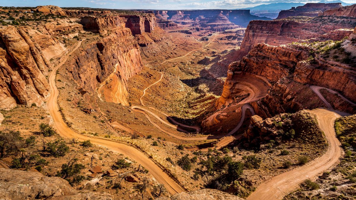
Image Credit: Harry Beugelink/Shutterstock.
The White Rim Road circumnavigates the Island in the Sky District below the paved roads on the plateau above but still above the Colorado and Green Rivers. High clearance is needed, and 4-wheel drive is a good idea in case it rains and the roads get muddy. The full loop is close to 100 miles, so have a full gas tank and a good spare (or two) before you start; help is far away (and extremely expensive) if you get stranded.
Toroweap– Grand Canyon, Arizona
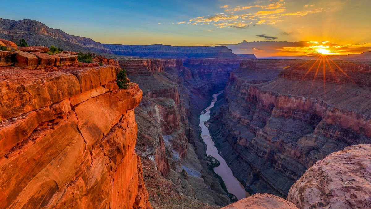
Image Credit: Invisible Witness/Shutterstock.
If the crowded overlooks at the Grand Canyon are too much for you, you’ll love Toroweap. The high-clearance road to this location on the North Rim starts outside the park and is about 60 miles of bumpy driving, but you end up at an isolated point on the canyon rim that most people either don’t know about or don’t want to bother with the effort of getting to. Here, the canyon isn’t as deep as it is in the heavily visited sections, but it’s much narrower, and it has cliffs that drop 3000 sheer feet to the Colorado River.
River Road– Big Bend, Texas
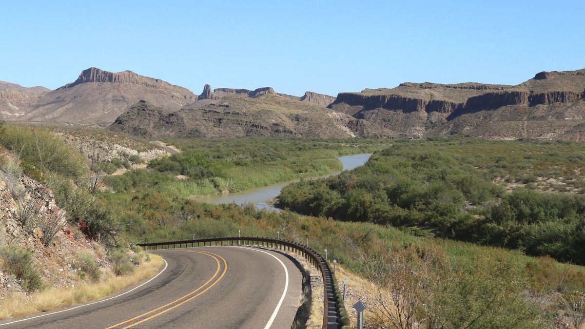
Image Credit: vagabond54/Shutterstock.
An unpaved route with ends near Tuff Canyon and Rio Grande Village on paved park roads, this trip has sweeping views of desert, mountains, and the Rio Grande. It also has access to the least-visited of the park’s three beautiful river canyons: Mariscal Canyon. High clearance is recommended for the main route; for spurs, it’s best to have 4-wheel drive as well.

Leave a Reply