
Southern Utah is known for spectacular scenery that attracts visitors from all over the world, and it’s so spectacular that it has a total of five national parks.
From east to west, they are Zion, Bryce Canyon, Capitol Reef, Canyonlands, and Arches. One of the best ways to enjoy these beautiful parks is to get out of the car and literally take a hike.
There are plenty of trails for all ability levels in them, and the following are the best of the best.
Zion– Angels Landing
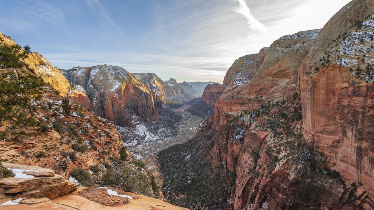
Image Credit: imageBROKER.com/Shutterstock.
This one isn’t for the faint of heart. A steep hike with seemingly endless switchbacks leads to an observation ledge. From there, a steep, narrow ridge heads to the summit. The ridge is so narrow and exposed in places that the Park Service has installed fixed posts and chains for hikers to hold onto. The reward is outstanding views of Zion Canyon.
Zion– Observation Point
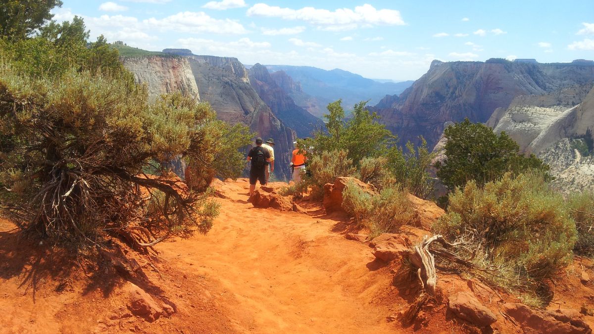
Image Credit: salilbhatt/Shutterstock.
If Angels Landing doesn’t seem like a thing for you, you can get very similar views and from a higher vantage point at Observation Point. There are two main ways to get there, but the classic one is to start from Weeping Rock in Zion Canyon and hike the many, many tiring switchbacks up to beautiful Echo Canyon. Then you hike through the canyon and up to the plateau above to reach Observation Point.
Zion– The Narrows

Image Credit:Stephen Moehle/Shutterstock.
One of the most famous hikes in America, the “trail” here is the Virgin River. Day hikers follow a paved path from the end of the road in Zion Canyon to where the canyon narrows. Then they enter the water and hike upstream, sometimes having to swim. It’s about three miles to the junction with Orderville Canyon where the canyon is at its narrowest and the walls are at their highest.
Bryce Canyon– Navajo Loop and Queens Garden
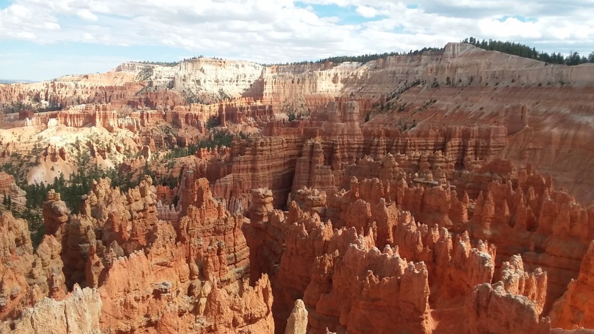
Image Credit: Sunflower in Colorado/Shutterstock.
There are many excellent viewpoints of the colorful hoodoos that fill the amphitheater here, but the formations are even better up close. This hike descends into the amphitheater and winds among the hoodoos, including the well-known Thor’s Hammer.
Capitol Reef– Hickman Bridge and Navajo Knobs
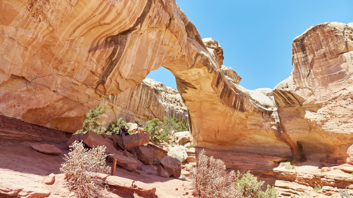
Image Credit: Sailingstone Travel/Shutterstock.
Hickman Bridge is a relatively short, moderately strenuous hike that’s good for almost every ability level. If you want more from the day, though, take the spur to the Navajo Knobs. This gets you high up on the sandstone rims, allowing sweeping views of some of the best scenery in the park.
Capitol Reef– Capitol Gorge and the Tanks
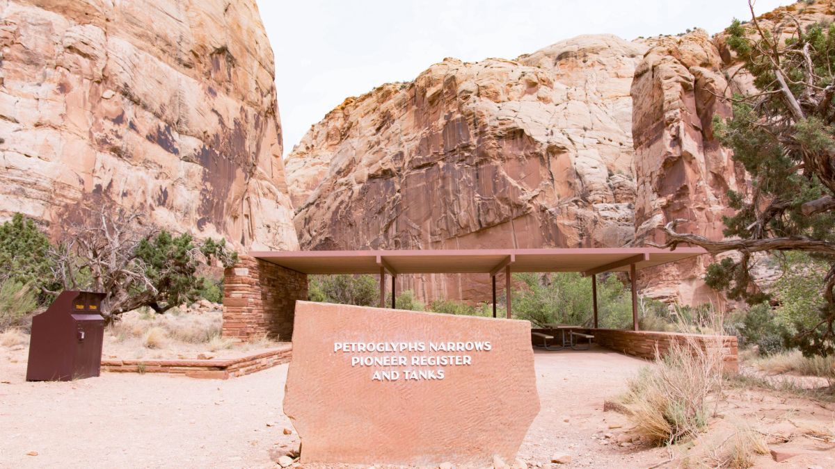
Image Credit: Brett Taylor Photography/Shutterstock.
The start of this hike goes through the narrows of Capitol Gorge, where you’ll see fascinating honeycomb-like formations on the walls as well as writings left behind by early settlers here. Then take a spur up to the tanks, a series of depressions that often have water in them. Adventure-minded people can continue cross-country to see amazing scenery that few people ever behold.
Capitol Reef– Upper Muley Twist Canyon
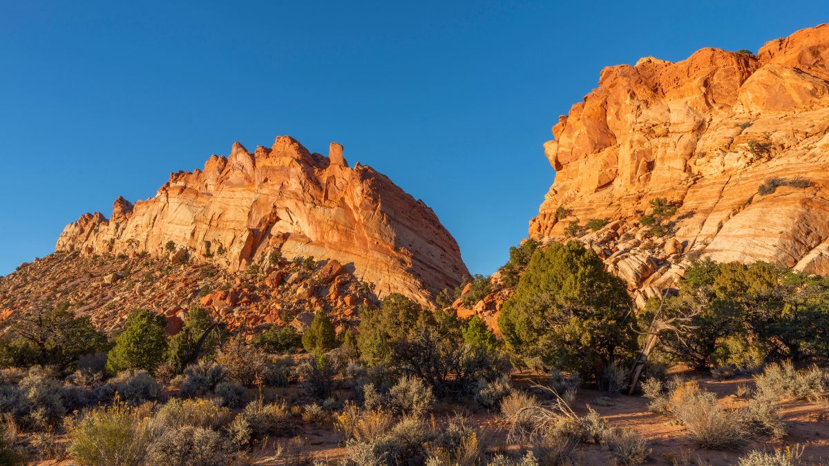
Image Credit: Danita Delimont/Shutterstock.
This hike is off the Burr Trail, a scenic byway that bisects the park in its southern section. You’ll probably need high clearance and four-wheel drive to get to the trailhead, but you can park before the road gets rough and hike the rest of the way in. Then you’ll start an amazing journey that includes several natural arches before climbing to the crest of Capitol Reef, where you’ll have panoramic views of colorful desert country and tall mountains.
Canyonlands– Horseshoe Canyon
Image Credit: Wisanu Boonrawd/Shutterstock.
It’s a long drive to this detached unit of the park, but the experience there is unforgettable. Things start out with petrified dinosaur tracks right off the trail. Then you descend into the canyon and pass a series of ancient Native American rock art sites, culminating in the Great Gallery, one of the most incredible and best-preserved pictograph panels in the country and all the world.
Canyonlands– Mesa Arch
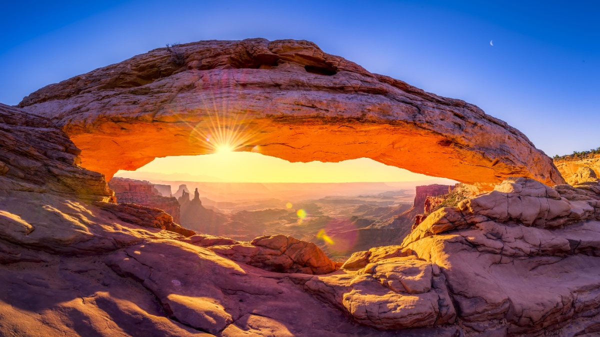
Image Credit:Dean Fikar/Shutterstock.
This one in the Island in the Sky District is super-short and super-easy. It’s best at dawn, when the rising sun lends a glow to the underside of the arch, and at sunset, when the reddening arch frames the La Sal Mountains to the east.
Canyonlands– Chesler Park
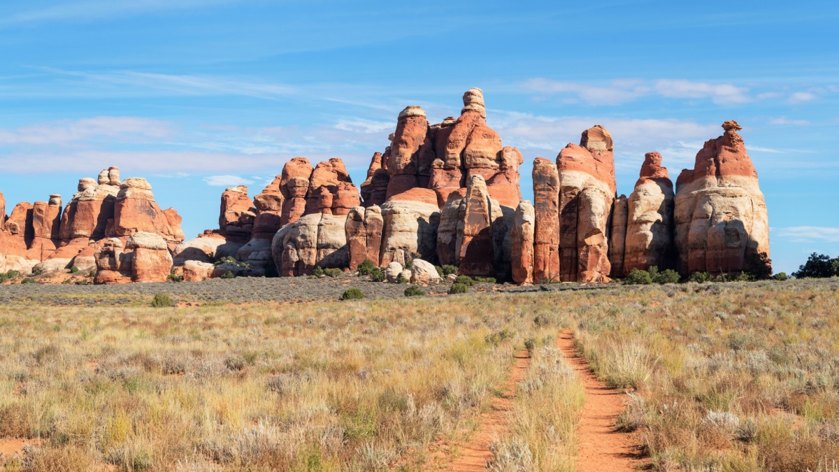
Image Credit:Danita Delimont/Shutterstock.
The Needles District is aptly named for its red spires that seem to pierce the sky. You can see them from roads, but the hike to Chesler Park, which you can turn into a loop, is the best way to get up close to these spectacular formations.
Arches– Devils Garden
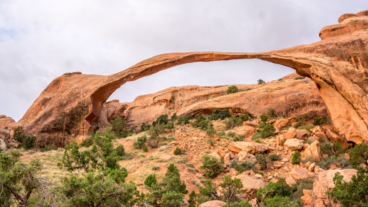
Image Credit:Scott Biales DitchTheMap/Shutterstock.
The Devils Garden Trail is overall the most scenic hike in the park. It’s mostly flat or with pretty gentle grades, and it passes several arches on the way to trail’s end at a spire called Dark Angel. One of those arches is Landscape Arch, one of the longest in the world.
Arches– Double Arch
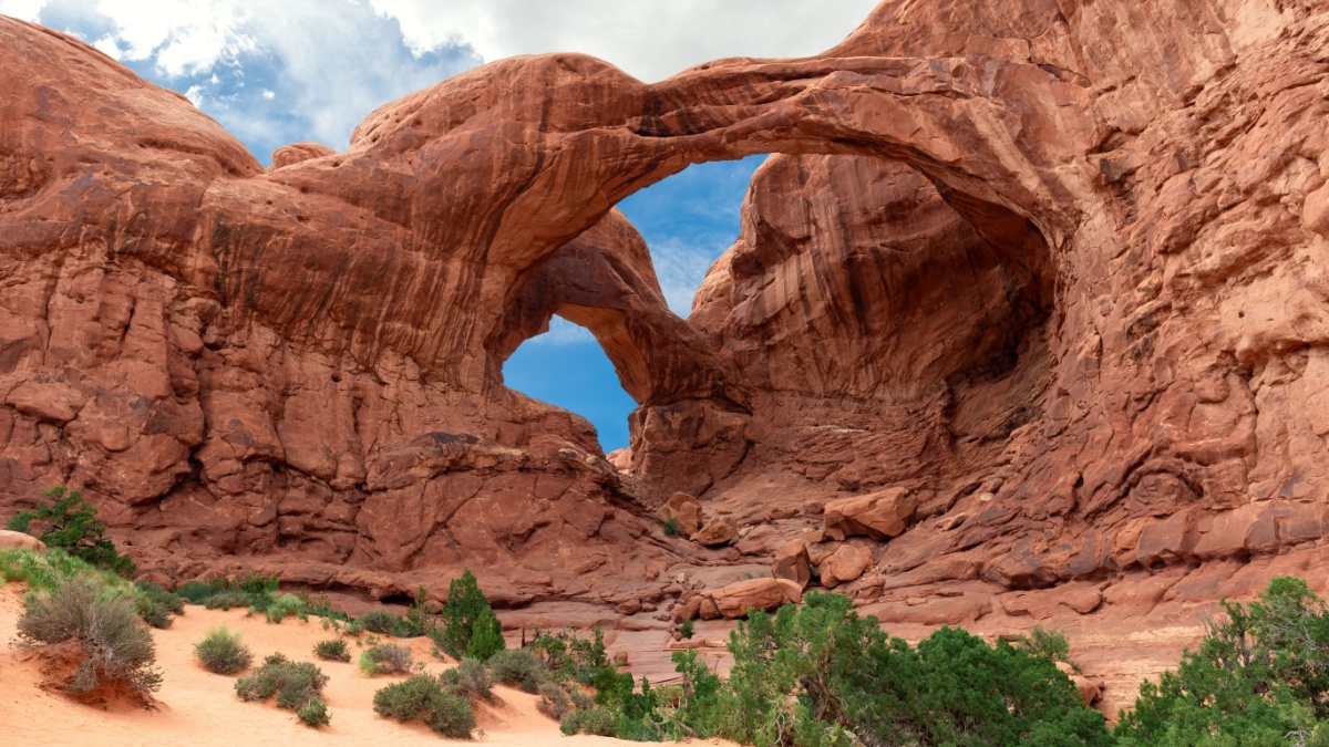
Image Credit: Andriana Syvanych/Shutterstock.
You can see huge Double Arch, which is featured in the opening scenes of Indiana Jones and the Last Crusade, pretty well from the road, but the short trail leading to it provides a more intimate experience that includes sitting directly beneath the massive spans of this arch.
Arches– Delicate Arch
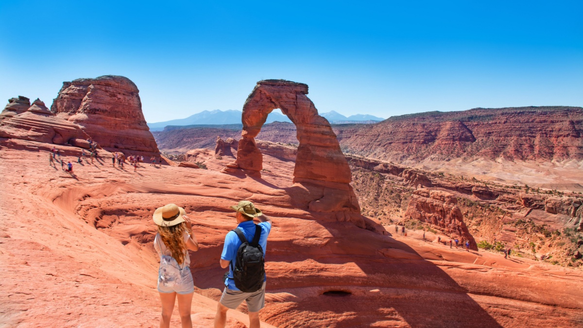
Image Credit:Margaret.Wiktor/Shutterstock.
Even if you haven’t hiked to this arch before, you’ve almost certainly seen it in pictures and on the license plates of many cars in Utah. The hike to it is only about 3 miles round
trip and moderately strenuous. For the classic view, go late in the afternoon as the lowering sun intensifies the colors as the arch frames the often-snowy La Sal Mountains in the distance.

Leave a Reply