
Colorful Colorado, nicknamed the Rocky Mountain State, is rightly famous for its mountain scenery.
However, the eastern third of the state is part of the Great Plains, and the western end of the state is mostly desert. Here’s a road tour that takes you through all of these zones and lets you more fully appreciate the beauty and diversity of this state.
Pawnee National Grassland
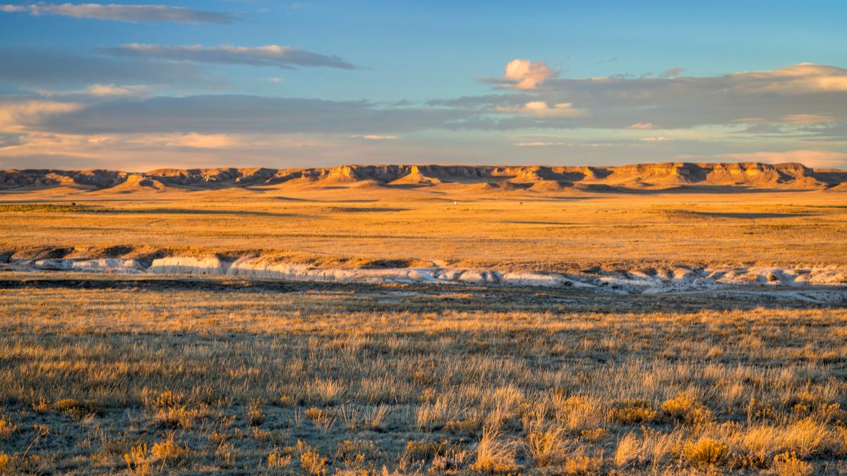
Image Credit: marekuliasz/Shutterstock.
Set in a remote and sparsely populated part of northeastern Colorado, this is an unspoiled and undeveloped section of the Great Plains. The geological highlights are the Pawnee Buttes and Chalk Bluffs, and there are hiking trails that get you to them.
Estes Park

Image CreditBrian Wolski/Shutterstock.
Estes Park is the main gateway town for Rocky Mountain National Park (RMNP). It’s always busy and just about always pricey, but it’s a fun town to visit, and it’s a perfect place to spend the night so you can get an early start in the national park the next day.
Bear Lake
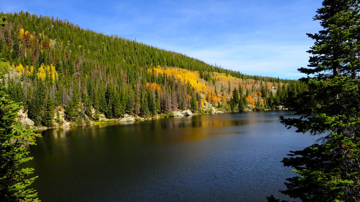
Image Credit: Don Fink/Shutterstock.
Bear Lake is at the end of the road named for it in RMNP. You can walk an easy loop trail around its shores, and there are benches in places for sitting and enjoying the scenery. Lovely Dream Lake is a short and pretty easy hike away, and Emerald Lake, which is higher and has even better views, isn’t that much longer and harder a hike.
Alberta Falls
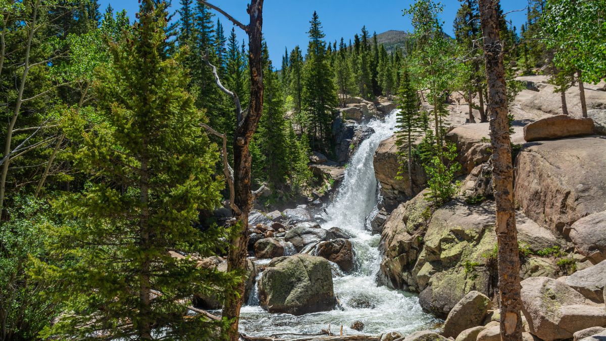
Image Credit: Margaret.Wiktor/Shutterstock.
This is a short walk to a waterfall along the road to Glacier Gorge. The parking lot is a short distance downhill from Bear Lake, but since you’re highly unlikely to find a parking spot at both places, it’s better to use one parking lot for both. Or skip the parking hassles and use the park’s free shuttle bus system.
Tundra Communities Trail

Image Credit:Sputnik Aloysius/Shutterstock.
Now drive back down Bear Lake Road and access Trail Ridge Road, the east-west scenic drive through RMNP. Eventually, the road passes timberline, and you’ll drive through alpine tundra for several miles. Stop at Rock Cut and get out to hike the easy Tundra Communities Trail to learn more about this ecosystem while enjoying spectacular views.
Milner Pass
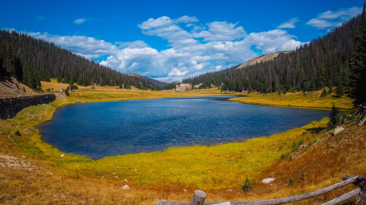
Image Credit: Jon Marc Lyttle/Shutterstock.
Trail Ridge Road crosses the Continental Divide here. It’s below timberline, so the views aren’t as good as they are higher up, but a steep trail gets you above the trees in short order. Once the official trail ends, an unofficial one continues along the ridges.
Colorado River Scenic Byway
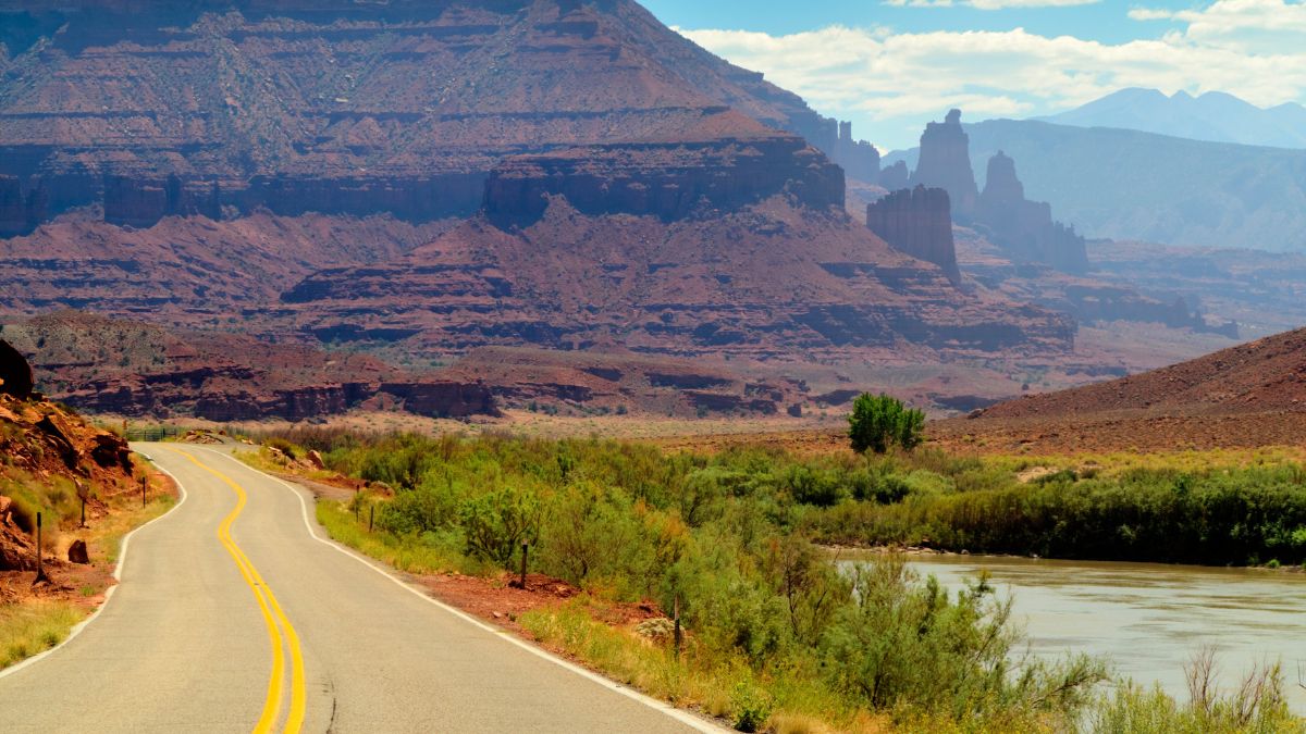
Image Credit: AustralianCamera/Shutterstock.
After exiting RMNP, you’ll reach the town of Granby. There, head west on U.S. 40; this is the start of the Colorado Headwaters Scenic Byway. It follows the upper section of the Colorado, which you saw as a mountain stream in RMNP, all the way to I-70 at State Bridge. Some of the roads are unpaved, but they’re fine for most vehicles.
Glenwood Canyon
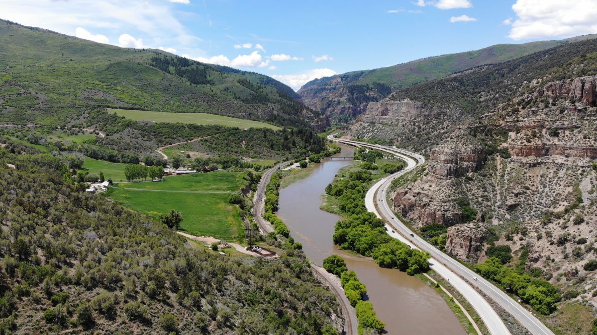
Image Credit: Chris Enright/Shutterstock.
Just a few minutes after you get on I-70, it follows the Colorado River into Glenwood Canyon, where there are impressive rapids and sheer, towering limestone walls. There are some exits that provide access to recreational areas that allow a better look.
Black Canyon of the Gunnison
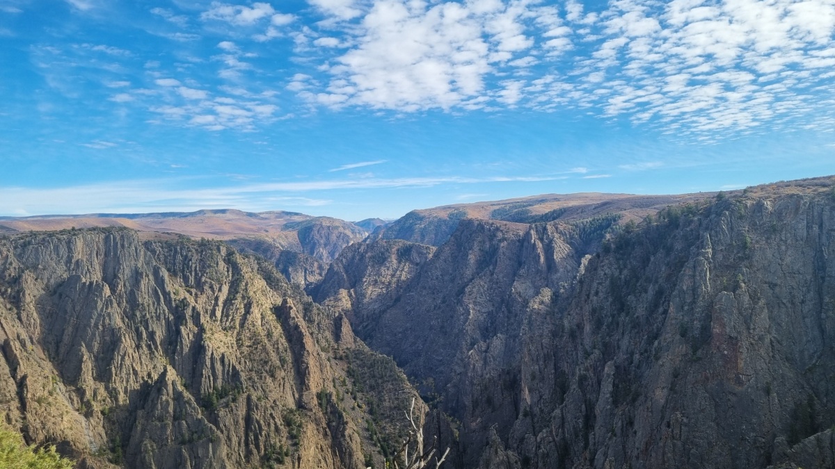
Image Credit:Riashj/Shutterstock.
Glenwood Springs is a resort town at the western end of Glenwood Canyon, and it’s a good place to spend the night after the day’s driving through the mountains and along rivers. From there, take roads south to Delta and Montrose and then east to Black Canyon of the Gunnison National Park. “The Black” isn’t as wide or deep as the Grand Canyon is, but it’s deep enough and a lot narrower. Most roadside overlooks at the Grand Canyon don’t let you see the river, but most here do.
Grand Mesa
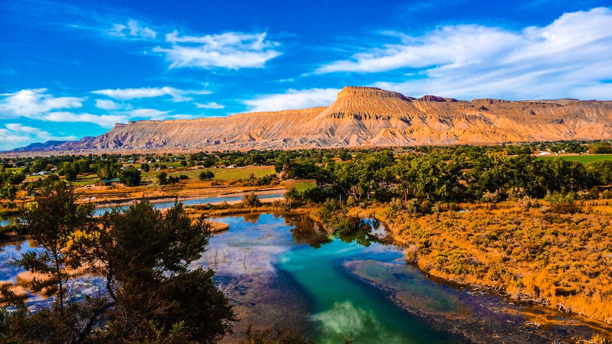
Image Credit: Chris Anthony Brian/Shutterstock.
Now backtrack to Delta and a short bit east of it to pick up SR 65, which climbs up onto Grand Mesa, which is not quite the mountains but definitely not the desert. This high mesa has a lot of natural lakes, and spots such as Land’s End provide spectacular panoramic views from the mesa’s edge. To continue the tour described here, follow roads to Mesa and then I-70 at Exit 49.
Mount Garfield
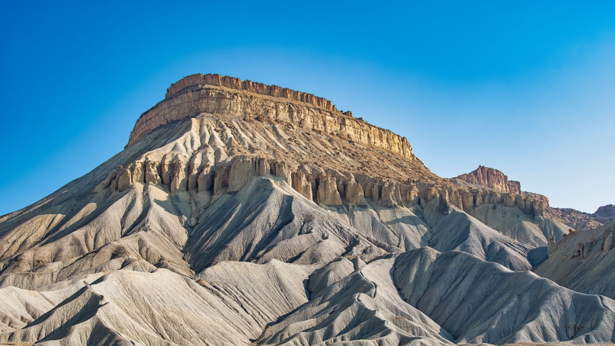
Image Credit: Thomas Kreulen/Shutterstock.
As you continue west on I-70 to Grand Junction, you’ll see colorful badlands and cliffs to the north. These are the Book Cliffs, and they extend well into Utah. Mount Garfield is a prominent peak there, and you’ll get great views of it from the highway, but there’s also a steep trail up it, and the summit has views that seem to stretch forever.
Colorado National Monument
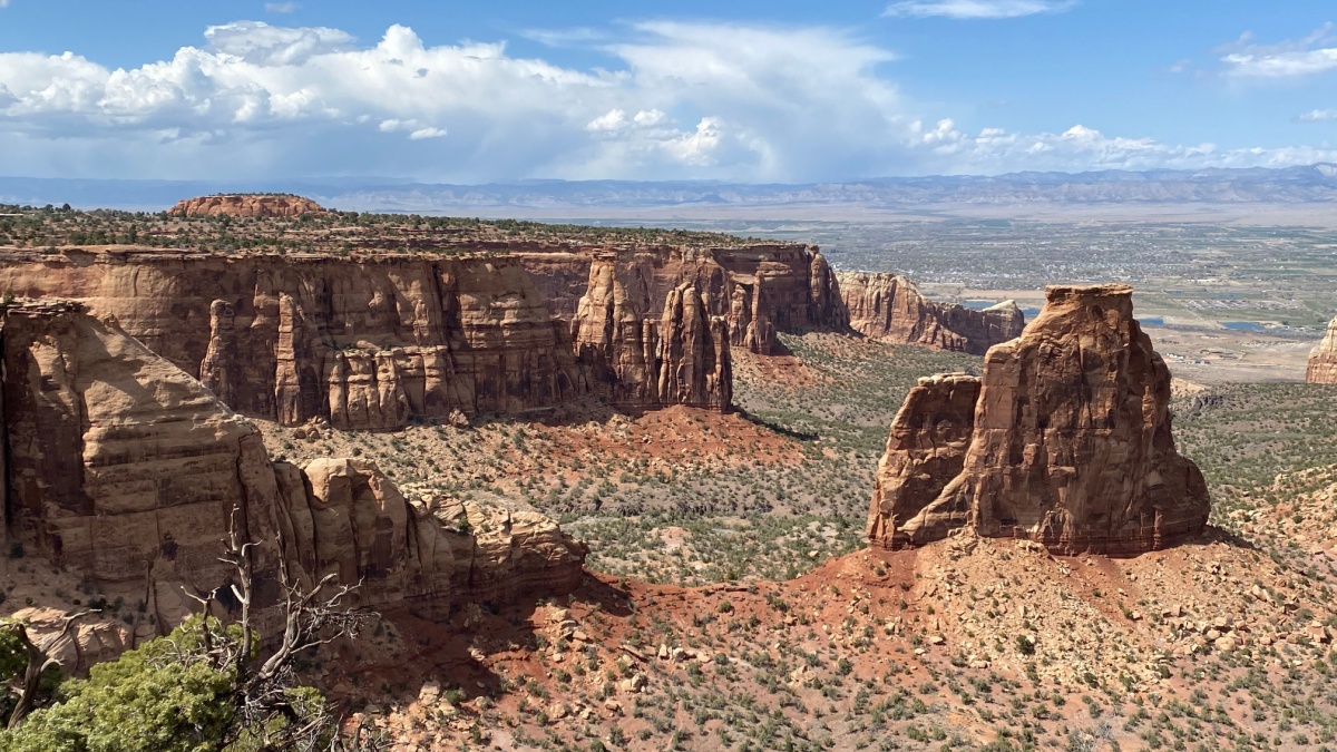
Image Credit: mikswe/Shutterstock.
Grand Junction or Fruita a short distance west is the final lodging spot on this tour. Both serve as good bases for enjoying Mount Garfield and the scenic gem of western Colorado’s desert, Colorado National Monument. 23-mile Rimrock Drive winds through this sandstone wilderness, connecting Grand Junction and Fruita. There are also some trailheads located along the park boundary.

Leave a Reply