
If you drive off the paved roads, you’ll face extra challenges but also see places most other people never will.
There are off-road adventures in every state, but Colorado and Utah have an especially high amount of top-quality routes, and since these states neighbor each other, you can get a lot of off-road awesomeness in just one trip.
Whether you’re doing a single trip or planning to make multiple visits, be sure to include some or all of the following among the hundreds of options available to you.
Old Fall River Road, Colorado

Image Credit:Tricia Daniel/Shutterstock.
This unpaved road in Rocky Mountain National Park is suitable for most passenger vehicles. It climbs up from montane forests to alpine tundra. At its upper end, it meets Trail Ridge Road, where you can head west out of the park or go back east to where you started. Trail Ridge Road is famous for winding through alpine tundra and endless views for several miles.
Argentine Pass, Colorado
Image Credit: JamesStevensPhotography/Shutterstock.
From historic Georgetown, follow the mostly paved Guanella Pass Scenic Byway up into the mountains. Before the pass itself, see a spur to the right for Argentine Pass. This is a true 4-wheel-drive route that involves a lot of rock crawling and lands you way above timberline on the Continental Divide.
Santa Fe Peak, Colorado
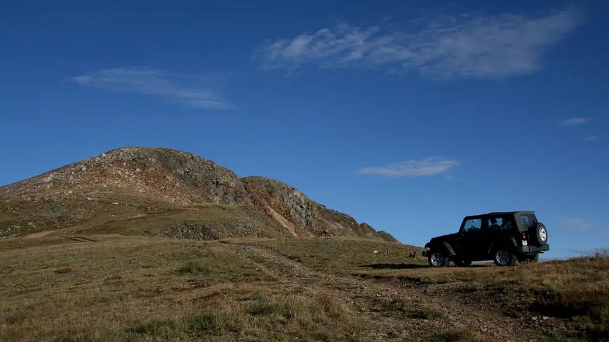
Image Credit: Robert Sihler.
High clearance and 4-wheel drive are needed here. From Keystone, you’ll drive to the small community of Montezuma, where the road turns to dirt. An unsigned road starts heading uphill into the woods, and after about 5 miles, you’ll be up on Santa Fe Peak. where you can get out to admire the views and also hike gentle ridges to neighboring peaks. Sections of the road are very steep, rock, and narrow, with sharp dropoffs.
Castle Creek Road, Colorado
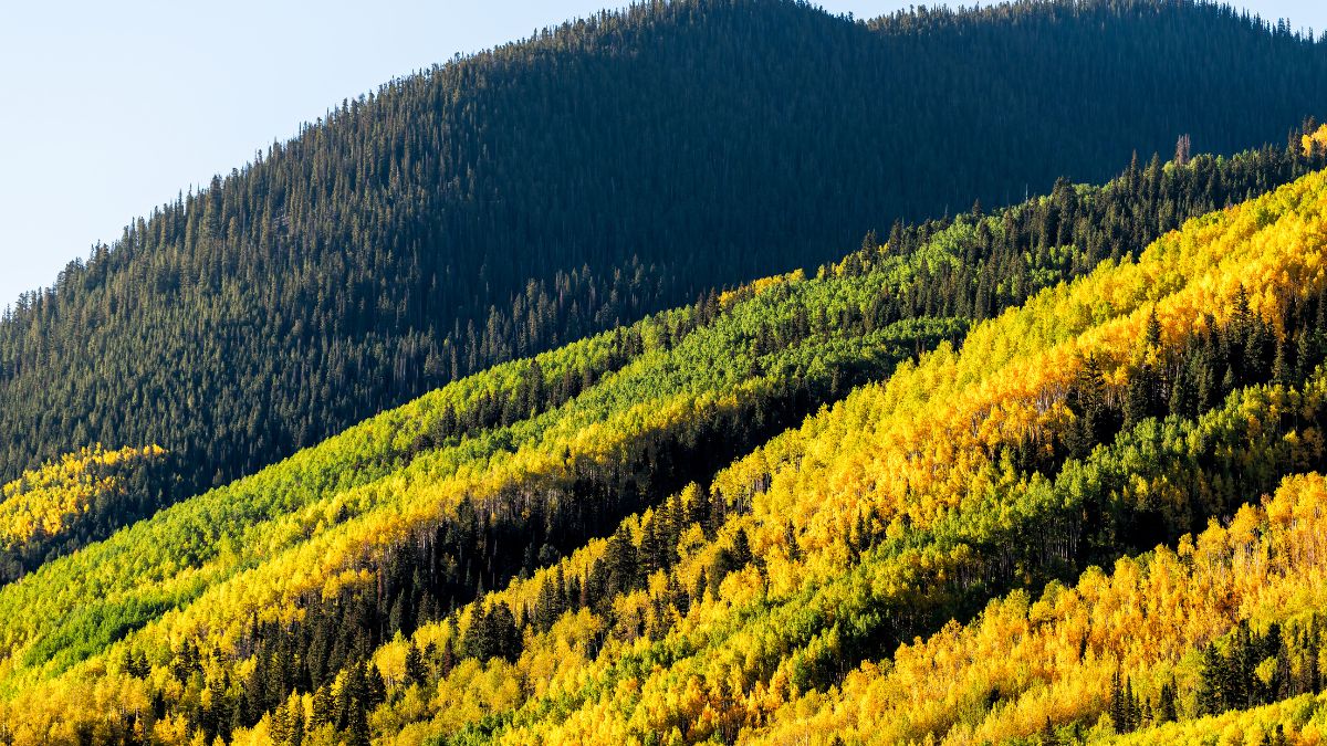
Image Credit: Kristi Blokhin/Shutterstock.
Near Aspen, this route gets you to old mine ruins and leaves you close to the summit of Castle Peak, the highest mountain in the Elk Range. It starts out pretty easy, but a little above 10,000’, there’s a stream crossing that can be serious depending on water levels. After that crossing, the road gets steeper and rougher. At an intersection, bear right on the Montezuma Road. This gets you to the ruins of the Montezuma Mine, where the road ends. If you’re up for the strenuous hike up the ridge to Castle’s summit, you’ll be rewarded with panoramic views that include the famous Maroon Bells.
Yankee Boy Basin, Colorado
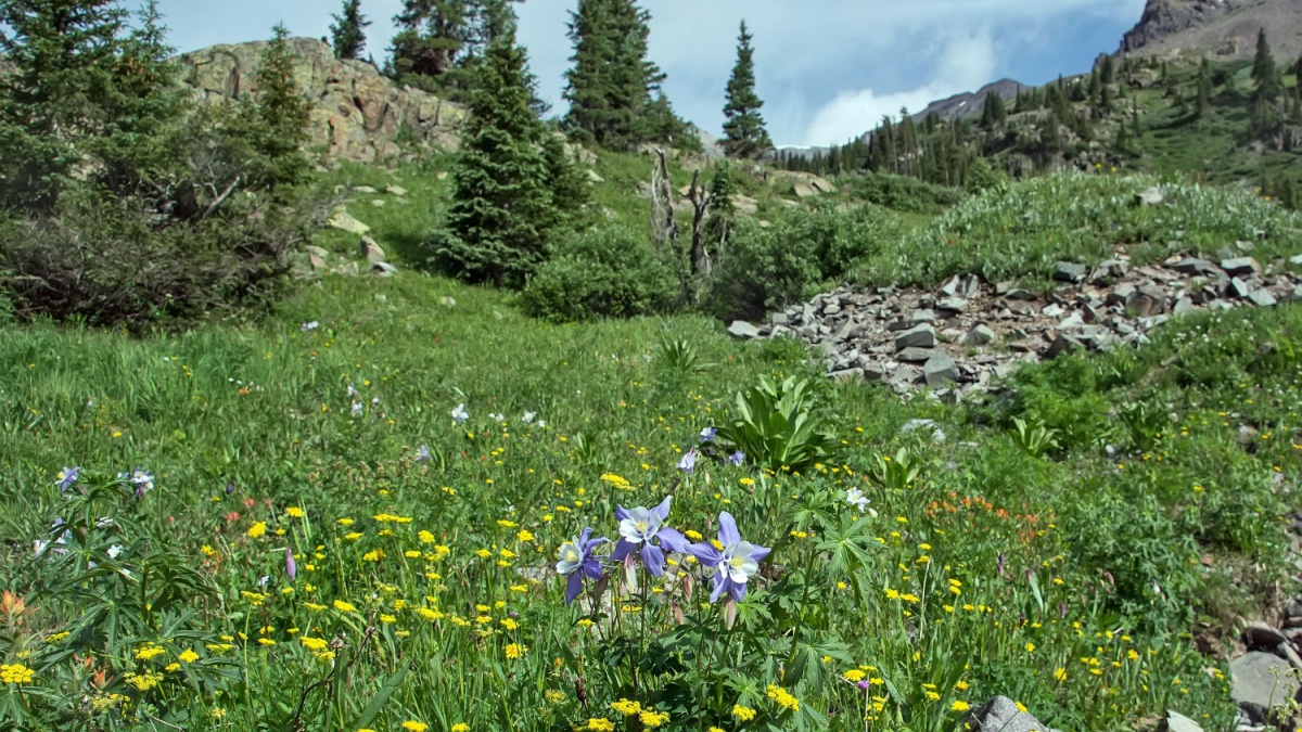
Image Credit:William Cushman/Shutterstock.
In the summer, Yankee Boy Basin is one of the best places in the country for alpine wildflowers. The road to Yankee Boy Basin leaves U.S. 550 just south of Ouray. Most passenger cars can make it to a spot called Camp Bird, where you can park and hike more of the road if you want (there will be a lot of traffic from 4WD vehicles). Continuing on to the end of the road requires both high clearance and 4-wheel drive, but you’ll reach a basin well above 12,000’ and in the shadow of Mount Sneffels, one of the prettiest and most famous mountains in the state.
Alpine Loop, Colorado
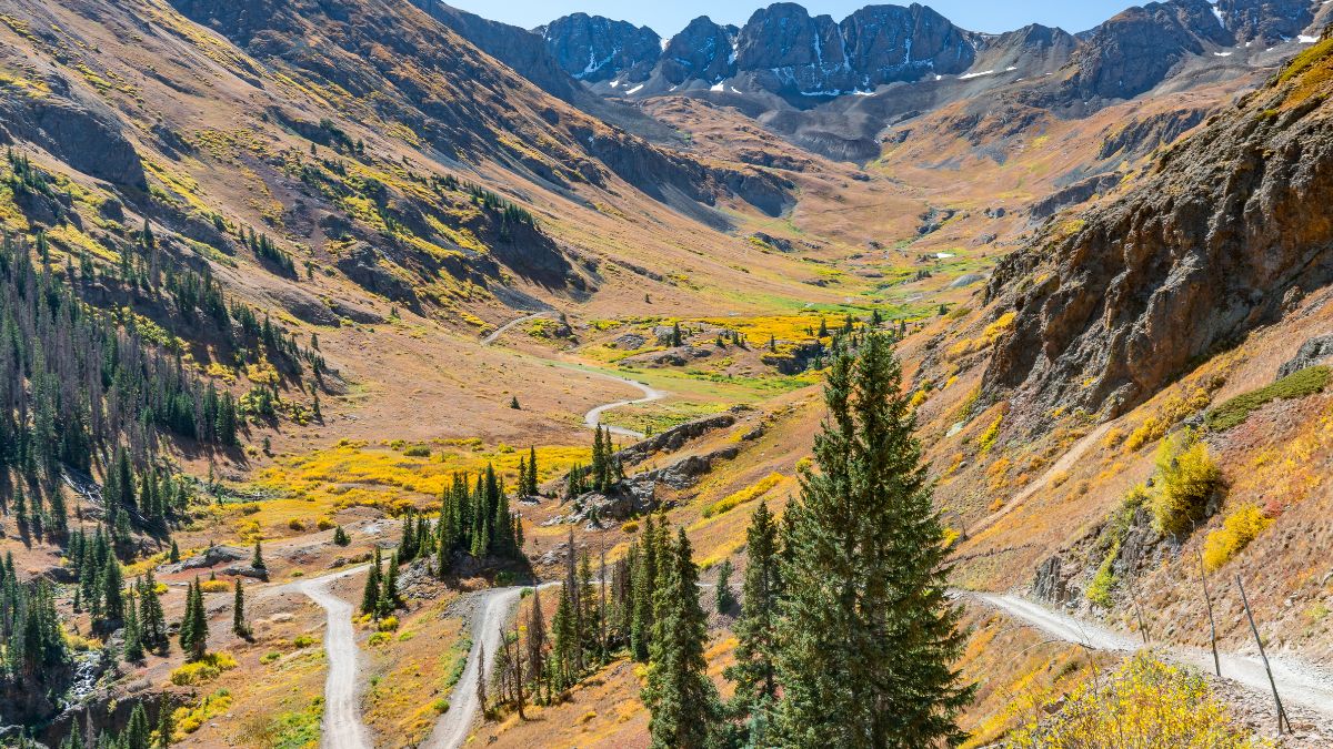
Image Credit: Paul Brady Photography/Shutterstock.
This is actually a network of unpaved roads linking the towns of Ouray, Silverton, and Lake City. There are two high mountain passes to cross, and you will see a lot of old mining ruins and alpine meadows as well. Passenger cars can make it from Lake City to some trailheads and from Silverton to Animas Forks, an awesome mining ghost town. Driving all of the route means a need for high clearance and 4-wheel drive.
Ophir Pass, Colorado
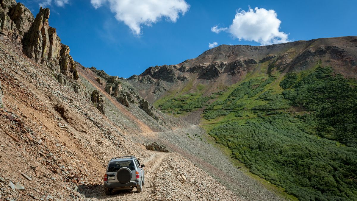
Image Credit: Laurens Hoddenbagh/Shutterstock.
Ophir Pass is on the crest of the San Juan Mountains between Ouray and Silverton, and it has excellent mountain views. With care, you can get a typical passenger car to the past from the east, but from the west, it’s strictly a 4-wheel drive affair. People with the latter type of vehicle like to use Ophir Pass as a shortcut between Telluride and Ouray/Silverton.
Buckhorn Wash, Utah
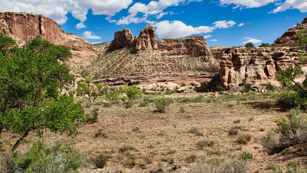
Image Credit: Laima Swanson/Shutterstock.
The best way to reach this drive is via Exit 131 off I-70 in Utah’s San Rafael Well. The road cuts back east along the interstate at first and then bends north as the pavement ends. Highlights include beautiful sandstone cliffs, peaks, and spires; ancient Native American pictographs at a well-preserved panel; and a fossilized dinosaur footprint. The road is bumpy at times but accessible to most passenger vehicles.
Cathedral Valley, Utah
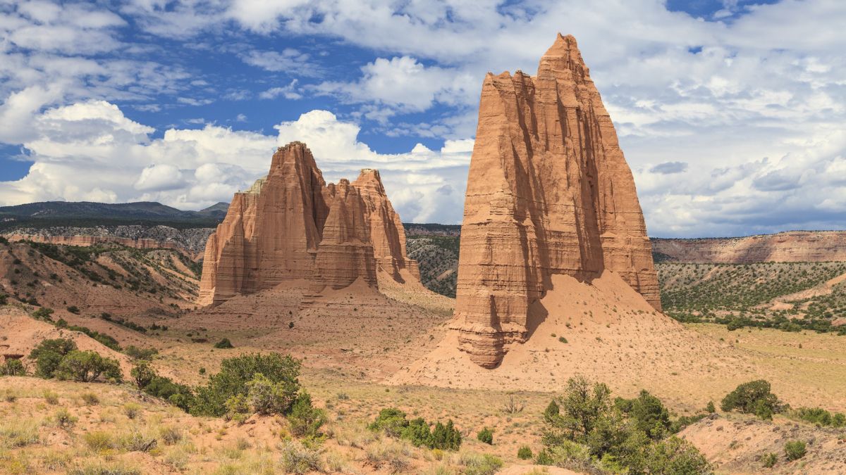
Image Credit: Guoqiang Xue/Shutterstock.
This route is a loop that has two start/end points a few miles away from each other on State Route 24. To do the full loop, you’ll need high clearance and 4-wheel drive for steep sections and a vehicle crossing of the Fremont River. Beautifully colored badlands grace the beginning and end of the trip, but the real highlights are Upper and Lower Cathedral Valley in Capitol Reef National Park, where sandstone monoliths dominate the scenery. If you have a regular passenger vehicle, you can use the eastern access point and make it to Lower Cathedral Valley, location of the spectacular Temple of the Sun and Temple of the Moon.
Notom-Bullfrog Road, Utah
Image Credit: Bonnie Fink/Shutterstock.
This long dirt road heads south from SR 24 all the way to Glen Canyon National Recreation Area. Along the way, there are spurs that access canyons, arches, and other features in southern Capitol Reef. Some of the spurs require 4-wheel drive, but the main road itself, when dry, is good for most passenger vehicles.
Horseshoe Canyon, Utah
Image Credit: Wisanu Boonrawd/Shutterstock.
Horseshoe Canyon is a detached unit of Canyonlands National Park known for having some of the best ancient rock art in the Southwest, with the crown jewel being the amazing Great Galley. It’s a long, dusty drive in from Green River or the state highway near Goblin Valley State Park, but most cars can handle it. A short way from the start of the hike into the canyon, you’ll pass two fossilized dinosaur tracks.
White Rim, Utah
Image Credit: Harry Beugelink/Shutterstock.
When you look down from overlooks in the Island in the Sky District of Canyonlands, you’ll see a flattish bench about halfway between where you are and the valley floor. This is the White Rim, and a dirt road winds along it for nearly 90 miles in all, circumnavigating the “Island” and getting you closer to rivers and desert towers. High clearance is recommended, and 4-wheel drive is also a good idea in case storms leave the road wet. You can do the whole drive in a long day, but there are also campsites along the way that you can reserve.
Hole-in-the-Rock Road, Utah
Image Credit: Stephen Moehle/Shutterstock.
Departing scenic SR 12 near Escalante, this dirt road leads over 60 miles to an historic river crossing that Mormon pioneers used to get across the Colorado (Lake Powell here now). When dry, the road is passable to most vehicles except for the last few miles, where 4-wheel drive or foot travel is necessary. The road has access to scenic areas like Coyote Gulch and Devil’s Garden and also to several slot canyons.

Leave a Reply