
The Rocky Mountain State has mountains covering about two-thirds of it, and in those mountains are a lot of lakes both large and small.
While there are many beautiful lakes in the state you can get to by car, most of the truly spectacular ones are accessible only by hiking trails.
Let’s go on a little tour of 12 of the best lakes in the state you can hike to. Some are very easy hikes, and others are going to burn a lot of calories!
Emerald Lake, Rocky Mountain National Park

Image Credit:Brian Wolski/Shutterstock.
You’ll actually see three lakes on this hike. It starts along the shores of Bear Lake and then heads up Tyndall Gorge to Dream Lake, which often reflects reddening Hallett Peak at dawn. After that, the trail gets a little steeper, but it’s not too bad, and you ultimately end up at Emerald Lake, the highest of the three lakes and the one with the best views.
Sky Pond, Rocky Mountain National Park
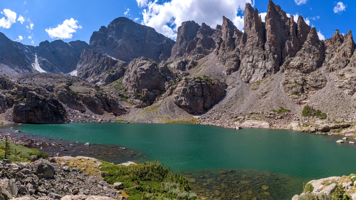
Image Credit: Sean Xu/Shutterstock.
The start of this hike is just down the road from Bear Lake at the Glacier Gorge Trailhead, and this hike also takes you to three lakes. Pay attention at trail junctions and keep heading toward the Loch. Once in Loch Vale, you’ll reach that lake. It’s pretty, but it pales before what’s to come. The trail soon steepens and pushes to timberline, where you’ll reach the Lake of Glass, on some maps called Glass Lake. Finally, you’ll reach Sky Pond, a true alpine tarn at the base of spectacular spires and the peaks and ridges of the Continental Divide.
Chasm Lake, Rocky Mountain National Park
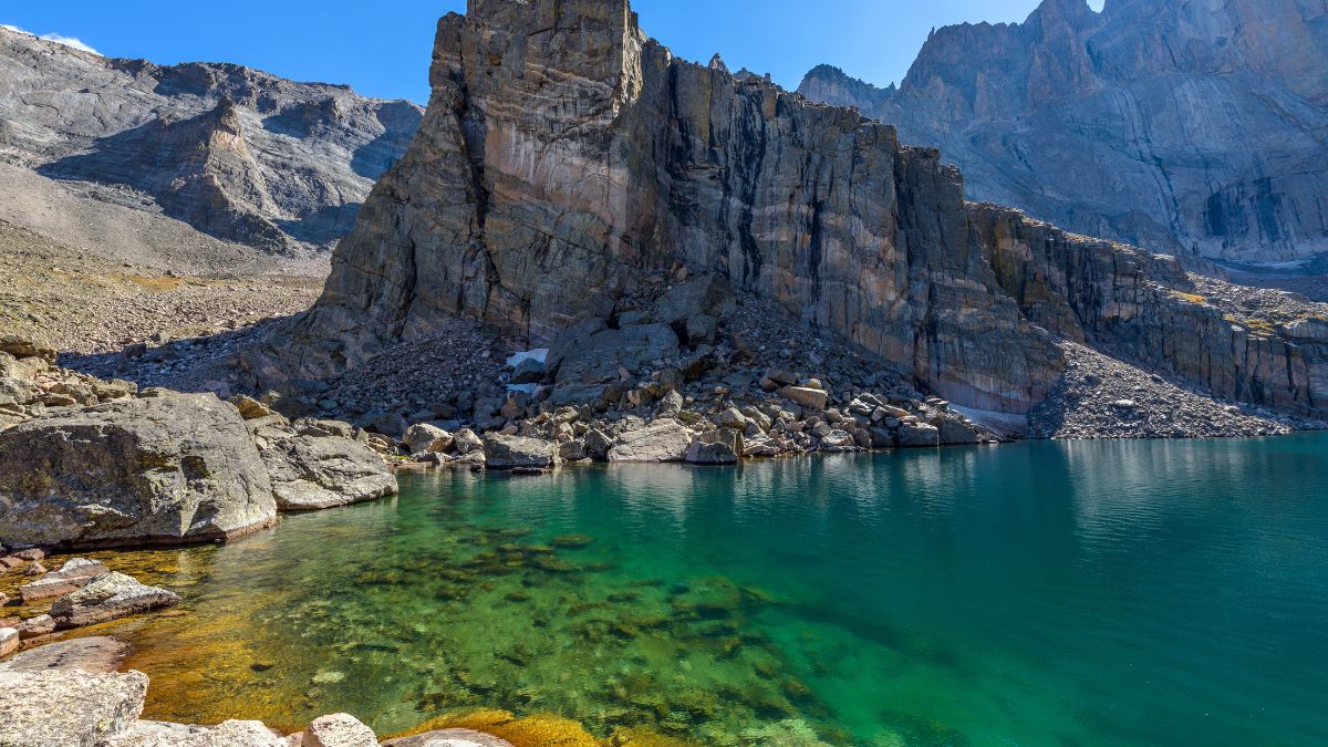
Image Credit: Sean Xu/Shutterstock.
The most popular way up Longs Peak, the park’s highest, starts from a railhead south of Estes Park. After a few miles, the trail breaks out of the trees, and you’ll reach a junction. Going left takes you to Chasm Lake, an alpine jewel at the base of a tall, sheer cliff on Longs Peak called the Diamond.
Blue Lake, Indian Peaks Wilderness
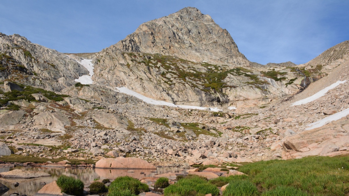
Image Credit: Jenny CC Carter/Shutterstock.
Just south of Rocky Mountain National Park, the Indian Peaks contain another stretch of rugged mountains and sparkling alpine lakes. The moderately strenuous hike to Blue Lake starts from the super-popular Brainard Lake Recreation Area. Blue Lake itself frames a perfect view of classically shaped Mt. Toll.
Herman Lake, Front Range
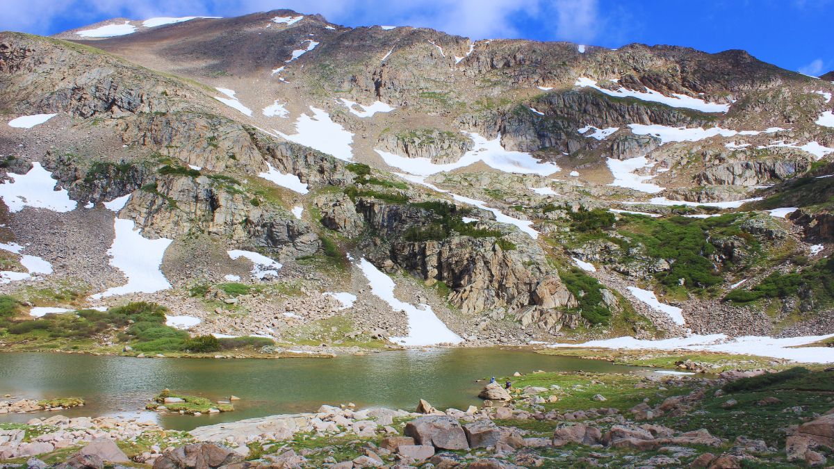
Image Credit: Carey On Travels/Shutterstock.
If you like to stop along the interstate to stretch your legs, you can do it in style and grandeur here. Along I-70, there’s an unnamed exit that leads to a parking lot and trailhead. Hike a little over 4 miles up Herman Gulch to Herman Lake, which sits beneath an impressive peak called the Citadel.
Crater Lake, Elk Range
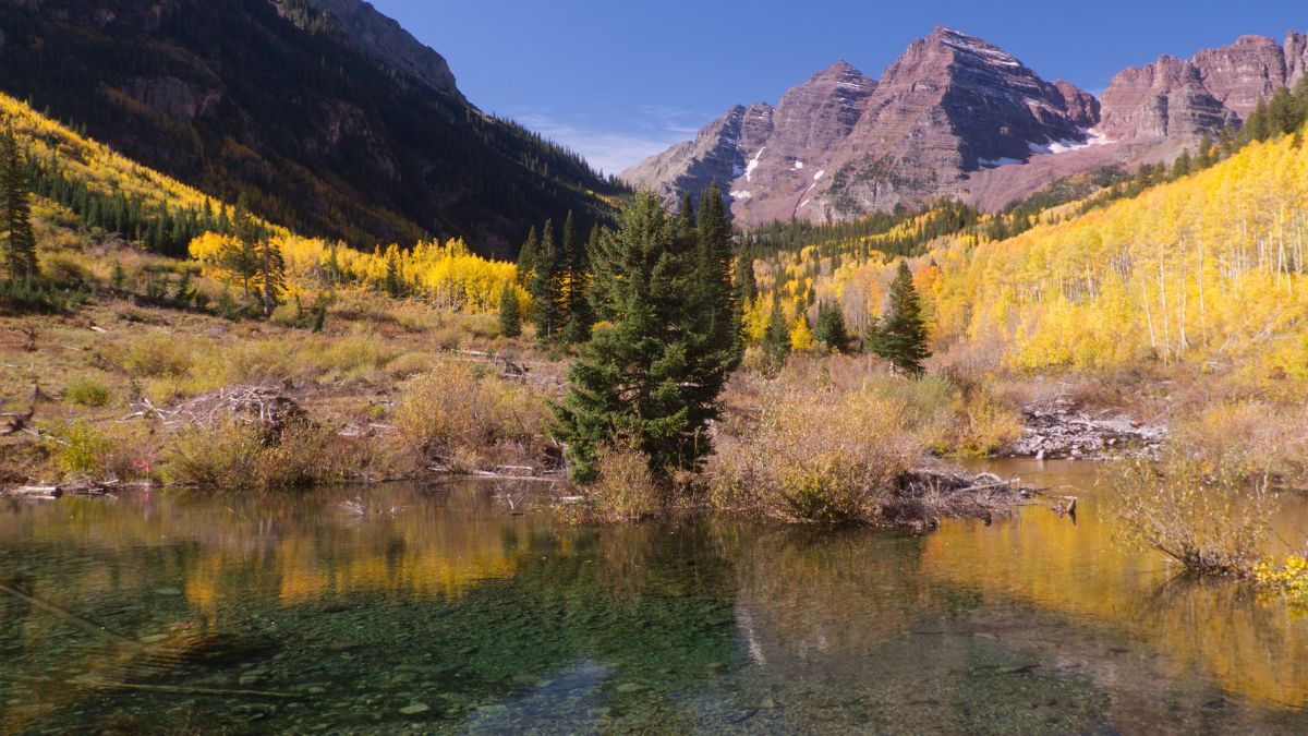
Image Credit: Ramsey Samara/Shutterstock.
Most people only see the famed Maroon Bells from Maroon Lake near Aspen. If you like that scene but want to get a little closer, Crater Lake is a great choice. The hike to it is under two miles and has modest elevation gain.
Snowmass Lake, Elk Range
Image Credit: Virrage Images/Shutterstock.
Getting to this lake requires a long, strenuous hike no matter how you go about it. It’s worth it, though; there won’t be many other people there, and the view of Snowmass Peak directly above is incredible.
Lost Man Lake, Sawatch Range
Image Credit: Cavan-Images/Shutterstock.
Independence Pass on the Continental Divide is about halfway between Aspen and Leadville, and the scenery is awesome. For more and even better, try the hike to Lost Man Lake. A short distance west of the pass, by a hairpin bend in the road, is a signed parking area. The trail here will take you first to Independence Lake. Then the trail climbs to a pass with a view of Lost Man Lake 400’ below with an unnamed peak rising above it.
Crystal Lake, San Juan Mountains
Image Credit: Susan McKenzie/Shutterstock.
Not a whole lot of people know about this lake, and it also has a striking blue color different from most other lakes around here. It’s a short hike south from Ophir Pass along an unsigned trail. The most challenging part is actually getting to Ophir Pass, which from the west requires four-wheel drive and from the east is okay with high clearance and even some passenger vehicles.
Ice Lake, San Juan Mountains
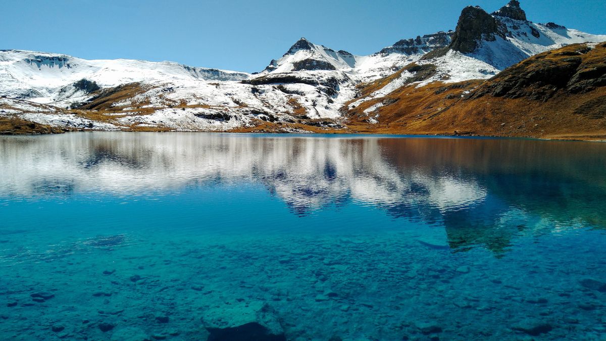
Image Credit: JMY Photography/Shutterstock.
Ice Lake Basin near Silverton is one of the most beautiful places in the San Juans. It’s a moderately strenuous hike of about 5 miles to get there, and even though most of the hike isn’t that remarkable scenery-wise, once you reach the basin itself, you’ll be amazed.
Island Lake, San Juan Mountains
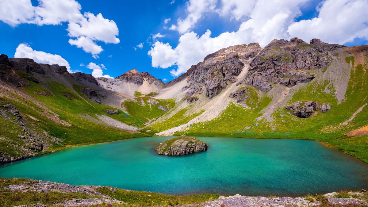
Image Credit: kojihirano/Shutterstock.
Use the same trailhead as you do for Ice Lake Basin. If you have a 4wd vehicle, you can actually drive all the way to the lake. Otherwise, treat the road as a trail and hike the 4-5 miles to reach this lovely lake. You can follow an unofficial trail past the lake to a divide with exceptional views of mountains all around.
South Colony Lakes, Sangre De Cristo Range
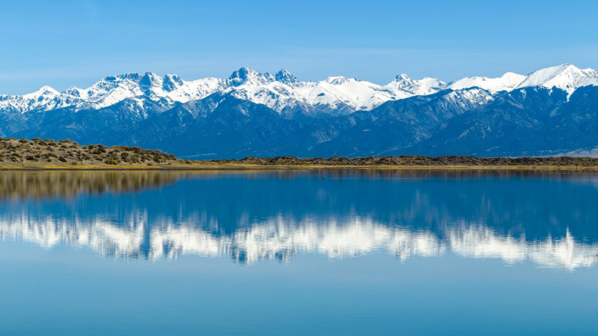
Image Credit: Sean Xu/Shutterstock.
The length of this hike depends on your vehicle. If you go from the 2wd trailhead, it’s an extra 2.7 miles than if you can make it to the 4wd trailhead. Either way, you won’t regret the time invested. These lakes are at the feet of an exceptionally spectacular part of the Sangre De Cristos known as the Crestones, with Crestone Needle stealing the show.
Read More:
Image Credit: Jacob Lund/Shutterstock.
Want some more great travel content?
Check this out: The 15 Most Beautiful Waterfalls in the U.S. You Need to See at Least Once in Your Life
and this too! 14 Great Sights from the Road in the American Desert Southwest

Leave a Reply