
Tourism is a huge industry in Colorado, and summer is the peak season.
There are four beautiful national parks there– Rocky Mountain, Mesa Verde, Black Canyon of the Gunnison, and Great Sand Dunes– but they can get really crowded.
In fact, Rocky Mountain has moved to a timed entry system to help manage all the traffic from late spring through mid-fall. The destinations here won’t be empty, but they won’t have the crowds and red tape that some of the national parks do.
This journey starts from Denver, but you can start anywhere you want and visit these places in any order you want.
Boulder
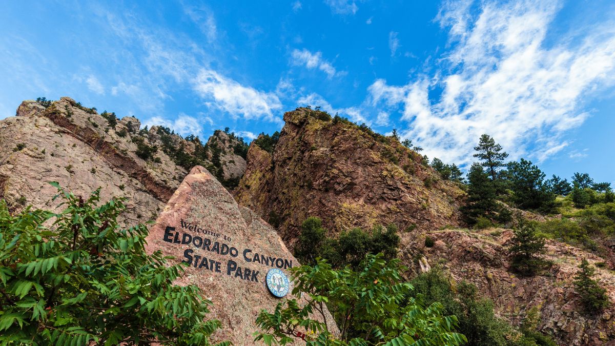
Image Credit: FotoKina/Shutterstock.
Boulder, if you can afford it, is one of the best places to live in America for the scenery, outdoor lifestyle, and vibrant culture. While in the area, visit any or all of the following: the Flatirons, Boulder Canyon State Park, and Eldorado Canyon State Park. All three are great for hiking and are also premier rock climbing destinations.
Brainerd Lake
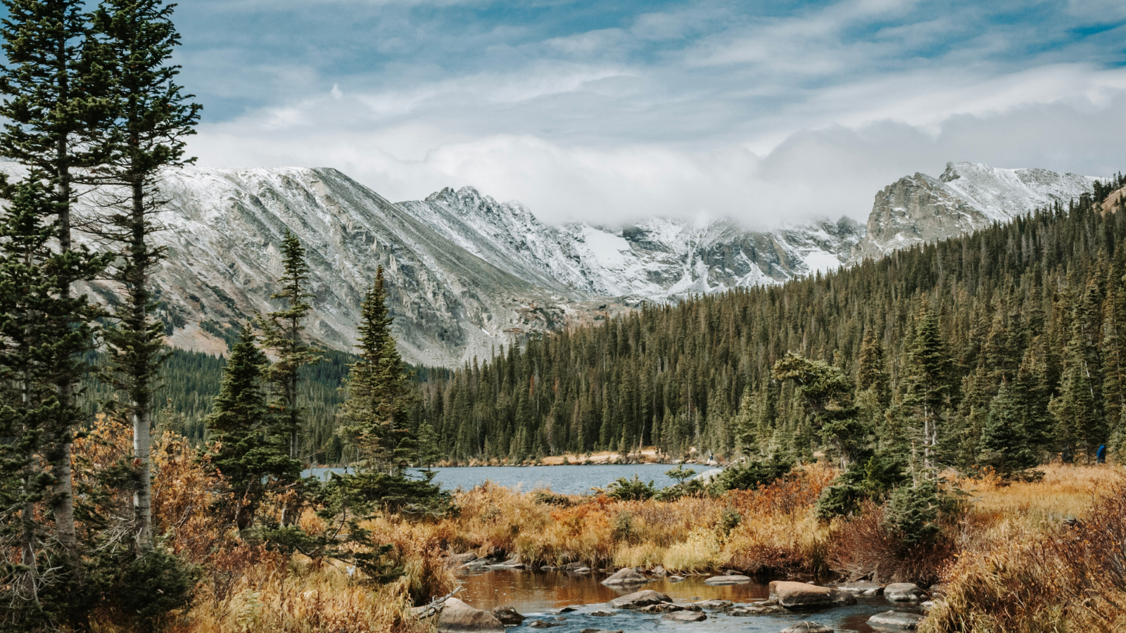
Image Credit: Mosaic Photography PGH/Shutterstock.
From Boulder, make your way west to SR 72 and Brainerd Lake at the edge of the Indian Peaks Wilderness. This is an area of spectacular peaks abutting the southern boundary of Rocky Mountain National Park, and trails lead to sparkling lakes and mountain passes and beyond. In summer, you do need a reservation to enter.
Mt. Evans
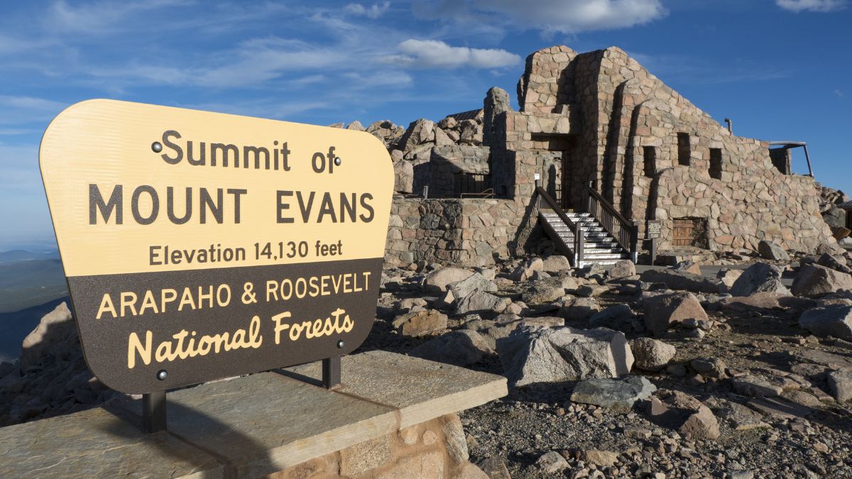
Image Credit: Paul Higley/Shutterstock.
From the Indian Peaks, drive south until you reach I-70 and the town of Idaho Springs. South of town, a toll road that sometimes requires a reservation makes its way to a parking lot just below the summit of 14,265’ Mt. Evans. Great spots to stop along the way, and these stops will help your lungs adjust to the altitude, include a gnarled forest of limber pines and then Summit Lake, at nearly 13,000’ and below the summit of Evans.
Georgetown and Guanella Pass
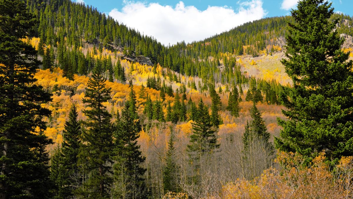
Image Credit: Jurekz/Shutterstock.
Georgetown is an historic mining town that, despite being right off I-70, hasn’t become overly developed and commercialized. From town, you can also drive up the Guanella Pass Scenic Byway, which is now fully paved. It crests at meadows beneath Mt. Bierstadt, another 14er you can hike up if you want to. A more adventurous and less-steep way to Bierstadt is from Mt. Evans via a ridge called Sawtooth Ridge that connects them.
Loveland Pass
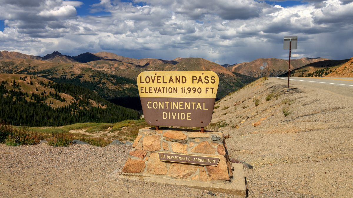
Image Credit: David S Mohn/Shutterstock.
Loveland Pass is on the Continental Divide just under 12,000’, and it’s the only alpine pass in Colorado kept open all year since it’s the route HAZMAT vehicles have to use instead of the Eisenhower Tunnel on I-70. There are beautiful views up there, and a moderately strenuous trail there will take you to the summit of Mount Sniktau, where the views are even better.
Leadville
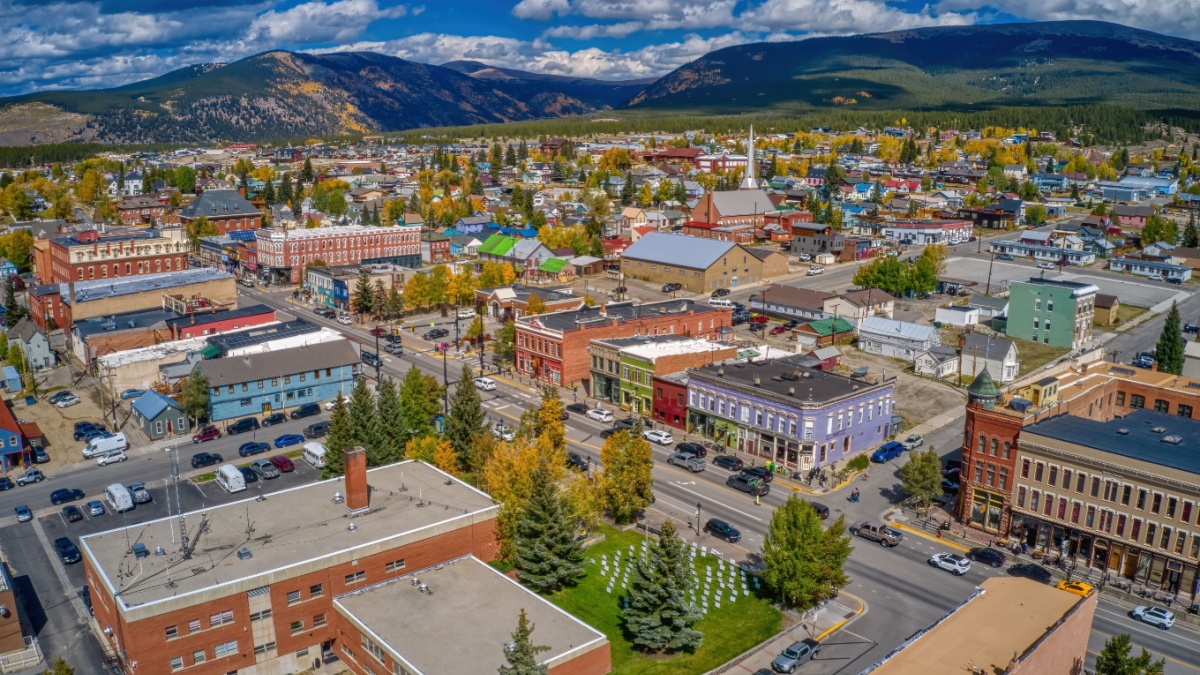
Image Credit: Jacob Boomsma/Shutterstock.
Exit I-70 to go south on SR 91, which joins U.S. 24 just north of Leadville, another historic mining town. Leadville, elevation 10,119’, is the highest incorporated town in the U.S. and a fun place to visit, and high mountains rise both east and west of town.
Independence Pass
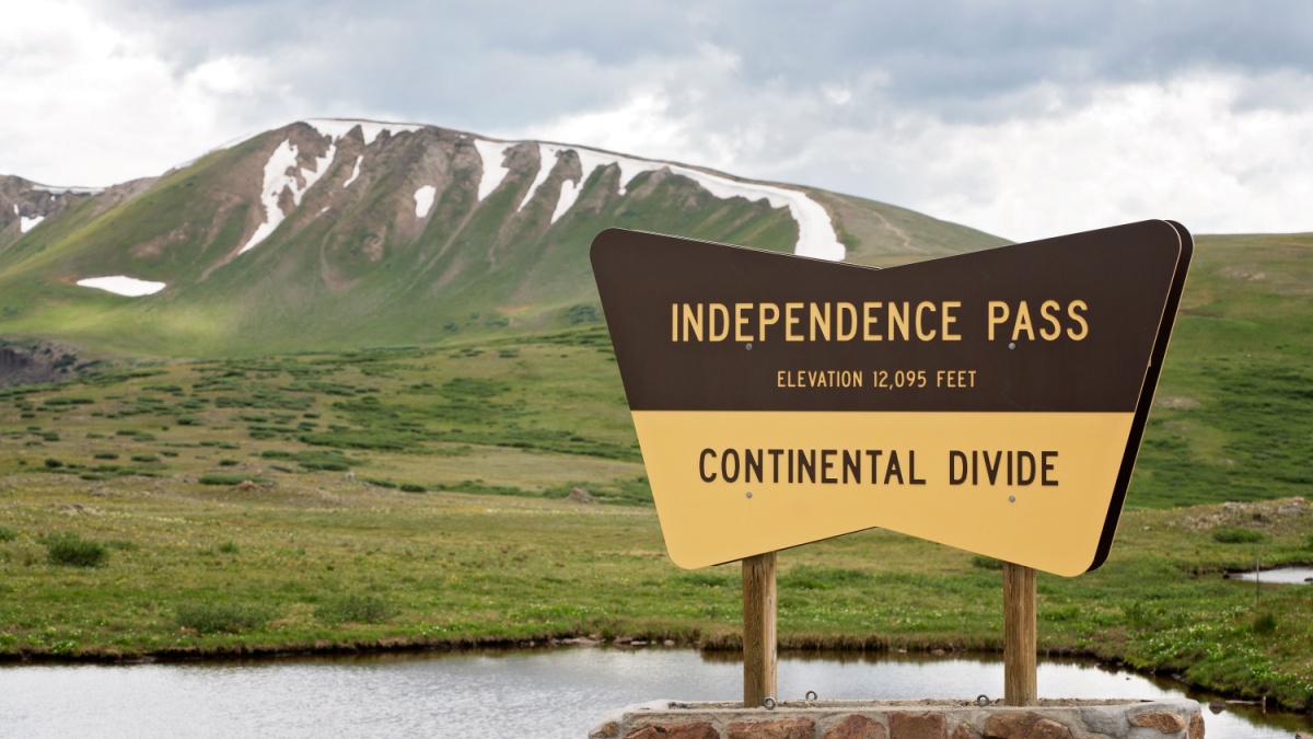
Image Credit:Christine Roth/Shutterstock.
Continue south from Leadville on U.S. 24, passing Mt. Massive and Mt. Elbert, respectively the second-highest and highest peaks in Colorado and all the Rockies, and then go west on CO 82. This state highway takes you up into increasingly beautiful scenery and crests at Independence Pass in the alpine tundra zone and on the Continental Divide. A few miles west from the pass is an old ghost town that’s worth a stop on your descent into Aspen.
Aspen and Maroon Lake
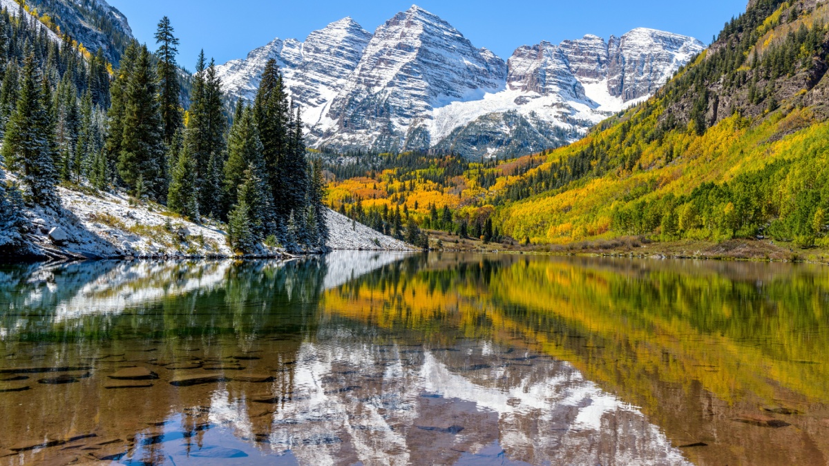
Image Credit:Sean Xu/Shutterstock.
Aspen is always busy and, with a few exceptions, insanely expensive, but it’s still a legendary Colorado town worth seeing at least once. Plus, it’s the gateway to Maroon Lake, which frames the Maroon Bells, two of Colorado’s most beautiful and iconic peaks. The Bells frequently make lists of must-see peaks in the country and even in the world.
Glenwood Springs and Canyon
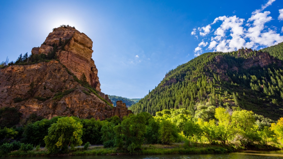
Image Credit: Steven Weinell/Shutterstock.
Continue on CO 82 to Glenwood Springs, which puts you back on I-70. This resort town isn’t cheap, but it’s not as expensive as Aspen is and makes a good place to spend the night. Don’t miss out on awesome Glenwood Canyon, which runs along the Colorado River for about 15 miles just east of town.
Colorado National Monument
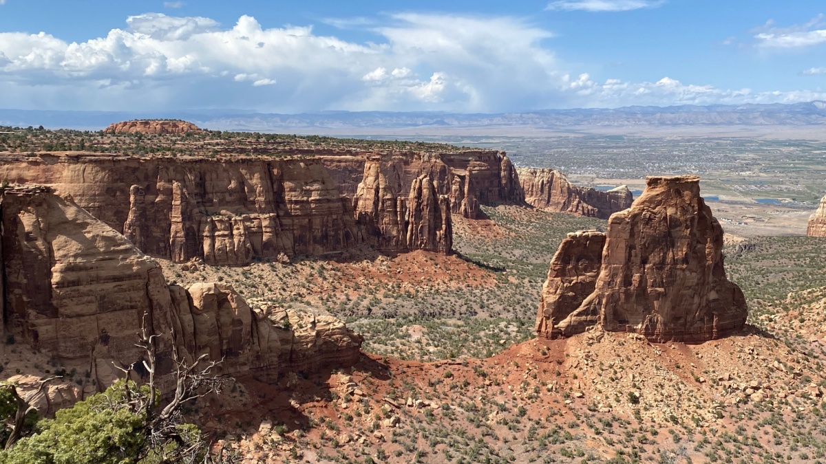
Image Credit: mikswe/Shutterstock.
Continue west on I-70 as it leaves the mountains behind and enters increasingly desert-like country even though the Colorado River is always next to you. Grand Junction and its neighbor Fruita to the east are gateways to Colorado National Monument, an area of scenic sandstone wonders. We said no national parks, but national monuments are fair game!
Ouray and Yankee Boy Basin
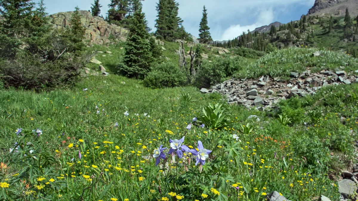
Image Credit:William Cushman/Shutterstock.
Head southeast from Grand Junction on U.S. 50 and then go south on U.S. 550 into the San Juan Mountains and Ouray. The San Juans are Colorado’s largest mountain range and its most colorful and spectacular. 550 runs directly through Ouray, so it’s usually slow going there, but the town is a good place to stay and/or get something to eat. Just south of town is a turnoff to Yankee Boy Basin, one of the most scenic areas in Colorado and one of the best places for alpine wildflowers, including blue columbines, the iconic state flower.
Silverton
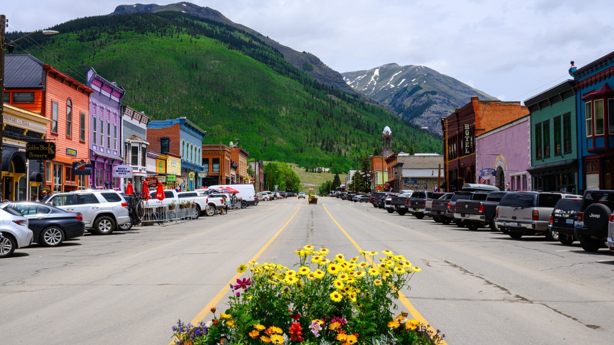
Image Credit: Ian Dewar Photography/Shutterstock.
Between Ouray and Durango, U.S. 550 is called the Million Dollar Highway. Some say it’s a nod to mining history, some say it’s for specks of gold supposedly mixed into the asphalt, and some say it’s for the scenery. Silverton is an old mining town along the way, and it’s surrounded by towering peaks. Because it’s off 550 and not directly along it, the traffic is much less stressful than it is in Ouray. Silverton is also the northern end of the historic Durango and Silverton Narrow Gauge Railroad, once a mining train but now a tourist excursion through mountain wilderness.
Canyons of the Ancients National Monument
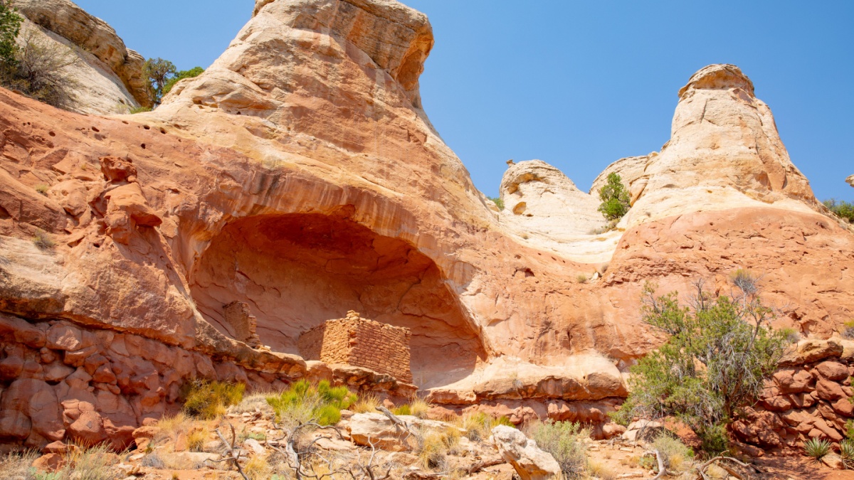
Image Credit: Traveller70/Shutterstock.
From Ridgway to Silverton, you were driving the San Juan Skyway, and it continues south to Durango, west to Cortez, and ultimately northeast back to Ridgway. Mesa Verde National Park is just east of Cortez, but if you want to appreciate ancient Native American art and architecture without the Mesa Verde crowds, check out Canyons of the Ancients, which is west-northwest of Cortez.
Telluride and Dallas Divide
Image Credit: John Hoffman/Shutterstock.
As you complete the San Juan Skyway, and this section is a lot less busy compared to the Ouray-Durango stretch, you’ll pass a spur leading to Telluride, a fun mountain and ski town that’s not a secret but which has resisted the tourist-trap vibes a lot of other Colorado mountain towns haven’t. In the vicinity, you’ll see Wilson Peak, a Colorado icon and the mountain featured on the Coors Light logo. Close to Ridgway, you’ll cross Dallas Divide, which has awesome views of Mt. Sneffels, another Colorado icon.

Leave a Reply