
With its many mountain ranges, Wyoming has a great number of natural lakes, and some are among the most beautiful and spectacular in the country.
You can drive up to or past many of them, but there are thousands more that require you to hit the trail. Following is a selection of both so that everyone can find something that’s right for them.
Beartooth Lake, Beartooth Range
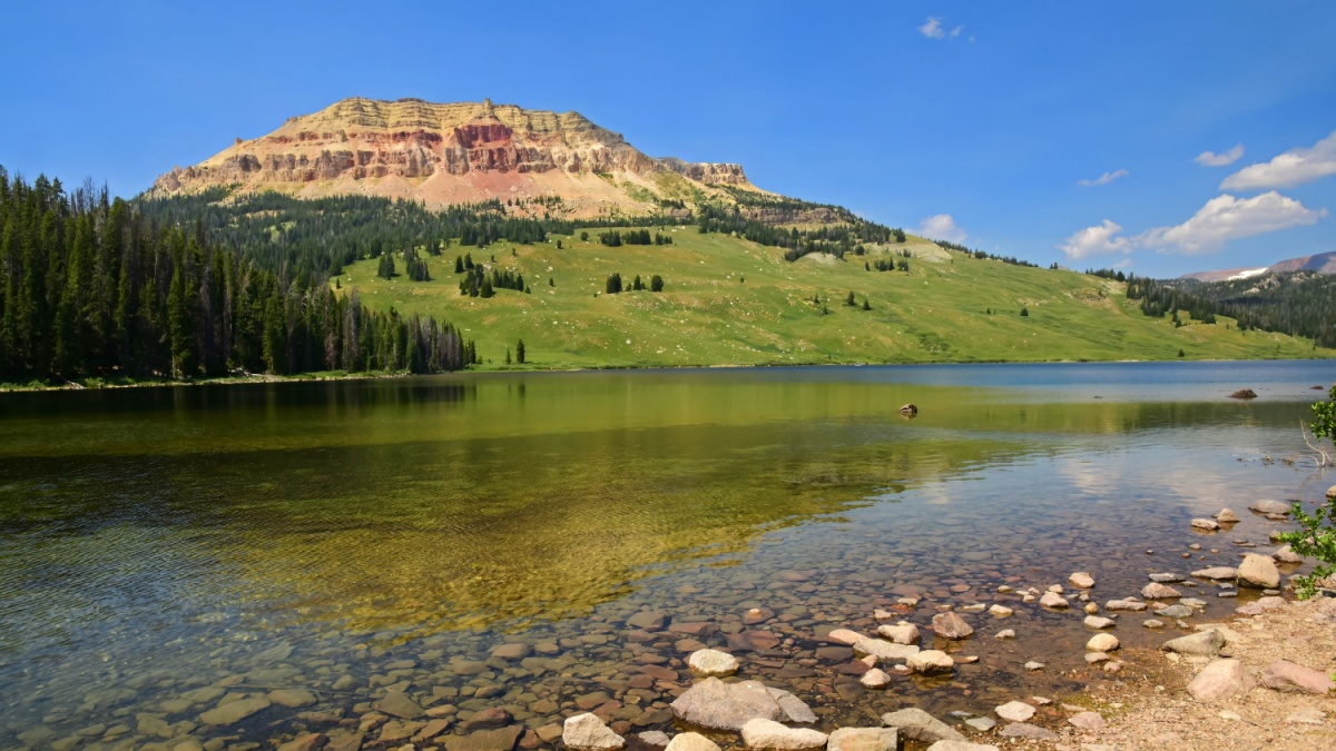
Image Credit: Nina B/Shutterstock.
Beartooth Lake is right off the famous and spectacular Beartooth Highway. Overlooking it is Beartooth Butte, which looks like something out of the Southwest more than it does something in the Rockies. It’s a popular spot for hiking, photography (especially when still waters reflect Beartooth Butte), fishing, and camping.
Yellowstone Lake, Yellowstone NP

Image Credit: Arlene Waller/Shutterstock.
Yellowstone Lake is the largest high-elevation lake in the country, and its waters are always cold. That doesn’t stop some hardy people from taking a dip in those waters, though. The lake also has an active geyser basin along its shores at West Thumb, and boardwalks provide foot access to it.
Brooks Lake, Absaroka Range
Image Credit:melissamn/Shutterstock.
The highway between Dubois and Grand Teton is a scenic one, but one of the best sights is off the main road. A few miles east of Togwotee Pass, look for the signed road going to Brooks Lake. This sometimes-bumpy dirt road ends in 5 miles at the lake, which has amazing views of the Pinnacle Buttes and the sheer cliffs of the Continental Divide known as the Brooks Lake Cliffs. The lake also has a campground and boat launch.
Green River Lake, Wind River Range
Image Credit: Evan Austen/Shutterstock.
The view of aptly named Squaretop Mountain from Green River Lake is sometimes said to be the most-photographed vista in Wyoming. Since it’s a long, bumpy drive from the Pinedale area to get there, that might not be true, but it’s definitely one of Wyoming’s most iconic images. Trails circumnavigate the lake, letting you get to know it better.
Fremont Lake, Wind River Range
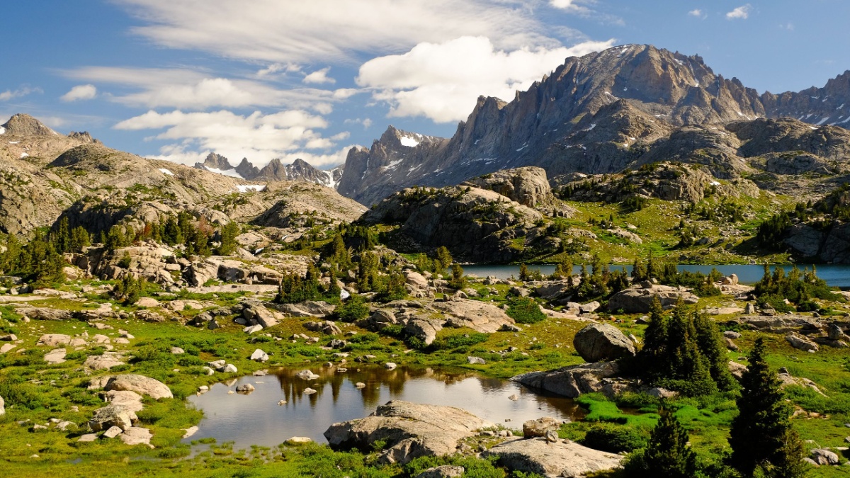
Image Credit: Tobin Akehurst/Shutterstock.
Just outside Pinedale, Fremont Lake is in the foothills of the Winds and off a paved road leading to the range’s busiest trailhead, Elkhart Park. The lake itself is surrounded by sheer granite cliffs, and the water color seems almost impossibly blue when you it from vantage points higher up the roads.
Lake Marie, Snowy Range
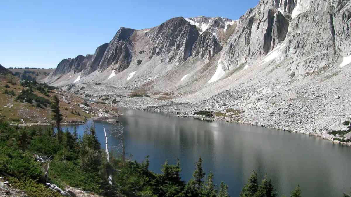
Image Credit: Robert Sihler.
The Snowy Range is a small but spectacular alpine range near Laramie that consists of four main peaks, alpine meadows, and several lakes. Lake Marie is right off the Snowy Range Scenic Byway and has a fantastic view of a feature on Medicine Bow Peak known as the Diamond.
Lewis Lake, Snowy Range
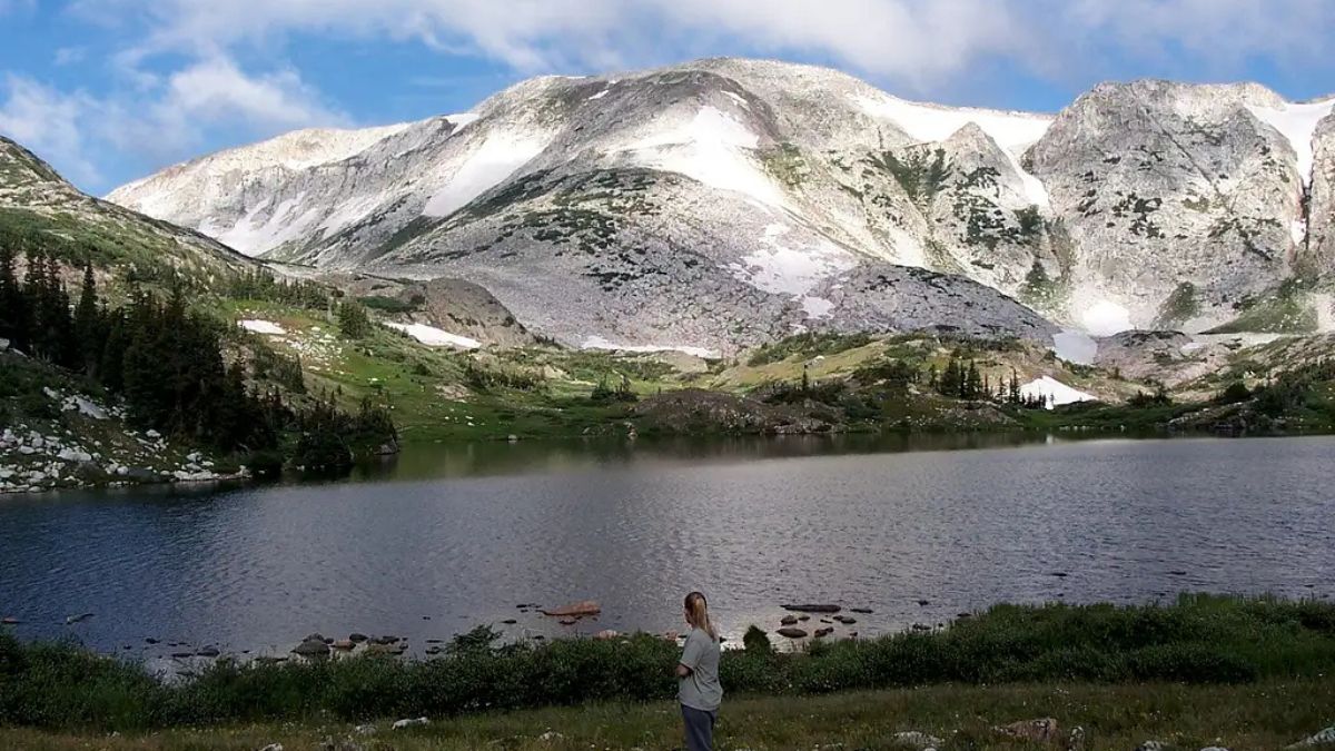
Image Credit: Robert Sihler.
Near the crest of the scenic byway, there’s an unpaved spur that leads north for about two miles to the Sugarloaf Recreation Area. This road ends at a parking lot next to Lewis Lake, which has excellent views of the mountains and is the starting point for some great hikes.
Mistymoon Lake, Bighorn Mountains
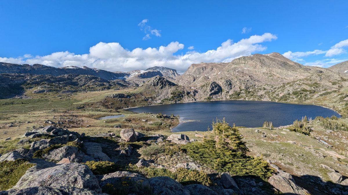
Image Credit: Joel Greene/Shutterstock.
Mistymoon Lake is a beautiful, popular alpine lake about 5.5 miles from West Tensleep Trailhead, which is off the scenic byway connecting Ten Sleep and Buffalo. Don’t expect solitude here, though, as it’s a popular destination for day hikers and backpackers alike, and it’s along the most commonly used route to the summit of Cloud Peak, highpoint of the Bighorns.
Lost Twin Lakes, Bighorn Mountains
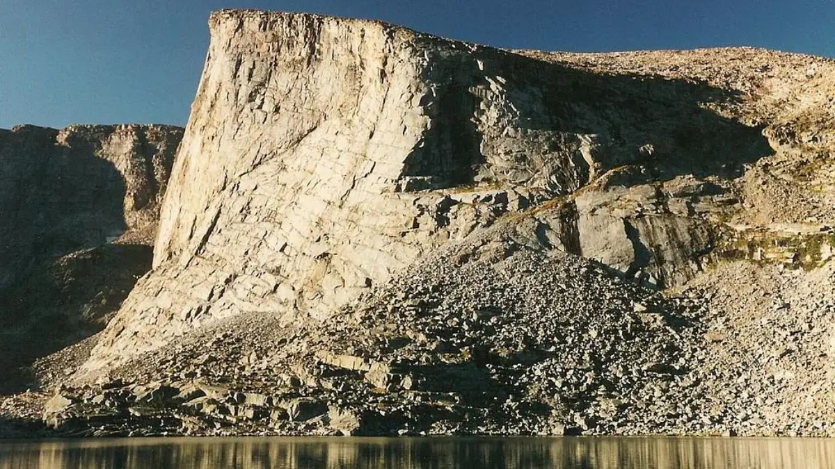
Image Credit: Robert Sihler.
If you are after solitude, you’re much more likely to find it at this lake, also at about 5.5 miles in and starting from the same trailhead as for Mistymoon. Sheer, unnamed cliffs flank this lake, and you’ll pass another lake, Mirror Lake, before you get to it.
Lake Solitude, Teton Range
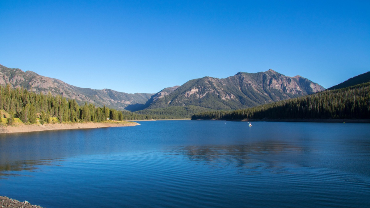
Image Credit: Joel Greene/Shutterstock.
You’re unlikely to find this lake’s namesake at it since it’s a very popular destination, but you should still go see it. It’s in North Fork Cascade Canyon and has a view of the Grand Teton and Mount Owen you can’t get from roads. For more lakes and even better views, do the entire Cascade-Paintbrush Loop; this 23-mile trek, which can be 19 if you utilize a boat shuttle both ways, is one of the best in the country.
Green Lake, Absaroka Range
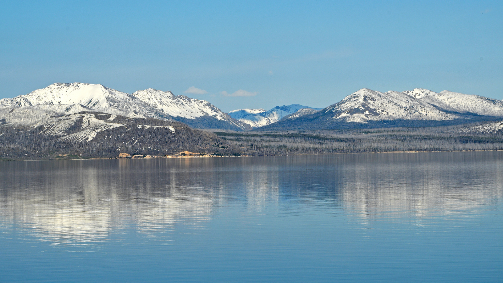
Image Credit: Brian A Wolf/Shutterstock.
Not really known for their lakes, the Wyoming Absarokas still have their share of gems. Getting to Green Lake is an undertaking, though. First, you drive for 60-90 minutes north from Dubois on mostly unpaved roads.
At the big parking area you eventually reach, get on the trail to Frontier Creek. This involves fording the creek, which can be difficult or dangerous in early summer when water levels are high. Then hike 9 miles up Frontier Creek, ultimately reaching an open basin with flower-filled meadows, Green Lake, and towering peaks. And you’ll probably have it all to yourself.
Titcomb Lakes, Wind River Range
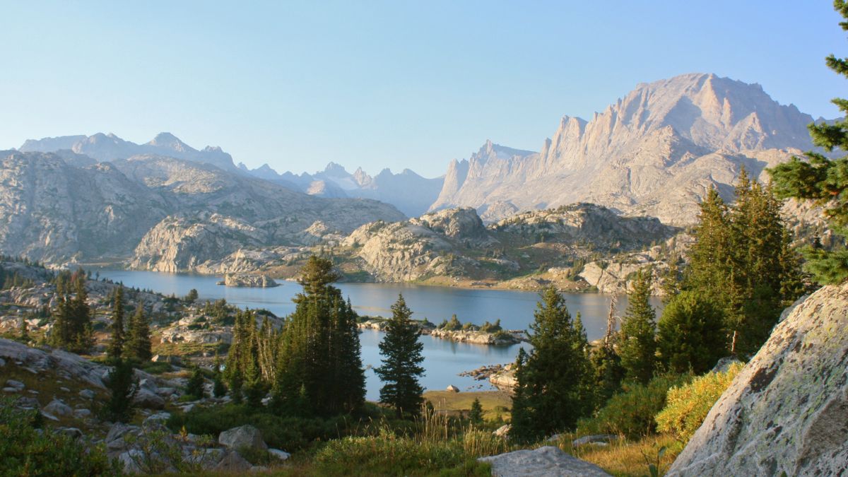
Image Credit: Alisha Bube/Shutterstock.
Titcomb Basin is one of the most spectacular mountain settings you’ll ever behold, and it justifies the efforts that so many people go to in order to see it. Most approach it by starting from the earlier-mentioned Elkhart Park. Titcomb Basin itself is about 12 miles in, and it has two lakes partially fed by runoff from nearby glaciers.
Nearby is Indian Basin, with its own lakes and peaks. Many people make a base camp in Titcomb Basin or a gateway spot, Island Lake, so they can spend a few days hiking and mountain climbing out here.
Lonesome Lake, Wind River Range
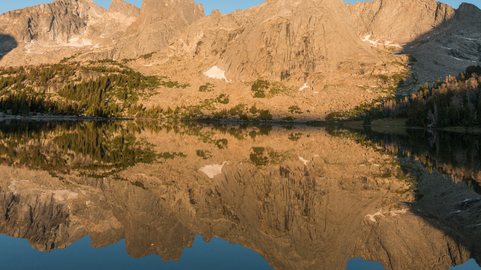
Image Credit: Michelle Holihan/Shutterstock.
Another world-renowned backcountry destination in the Winds is the Cirque of the Towers. The main starting point is Big Sandy, a long drive from anywhere, and the hike goes over the Continental Divide, ultimately reaching Lonesome Lake and the Cirque after about 10 miles. Lonesome Lake frames one of the most renowned peaks in the Cirque: Pingora Peak.
South Gap Lake, Snowy Range
Image Credit: Hank Erdmann/Shutterstock.
From the Sugarloaf Recreation Area mentioned before, take a trail marked for South Gap Lake. It’s a scenic, mostly easy hike to South Gap Lake. From there, you can hike up to the gap in the mountains above it, from which you have a nice view of North Gap Lake. A lot of people make this a loop hike.

Leave a Reply