
The first time I visited Glacier National Park in Montana was July 2, 1997.
We entered from the west side, and although it was pretty, it became a true revelation as my wife and I, then still my girlfriend, got higher and higher up Going-to-the-Sun Road (GTTSR), and the most revelatory part of it was was at Logan Pass, which is the crest of the road and on the Continental Divide at timberline. Back then, we had no trouble parking at Logan Pass. Since then, though, word about Glacier has “gotten out.”
It’s now among the most-visited parks in the country, usually in the top ten each year, and parking at Logan Pass has become a nightmare. Sometimes, it fills up by 6 in the morning, and it’s a big parking lot.
Despite how much busier Glacier has become, it’s still our favorite place, so here are some ways to enjoy its grandeur without the masses and without having me reveal some of its many secrets I’ve discovered.
Save Logan Pass for Day’s End
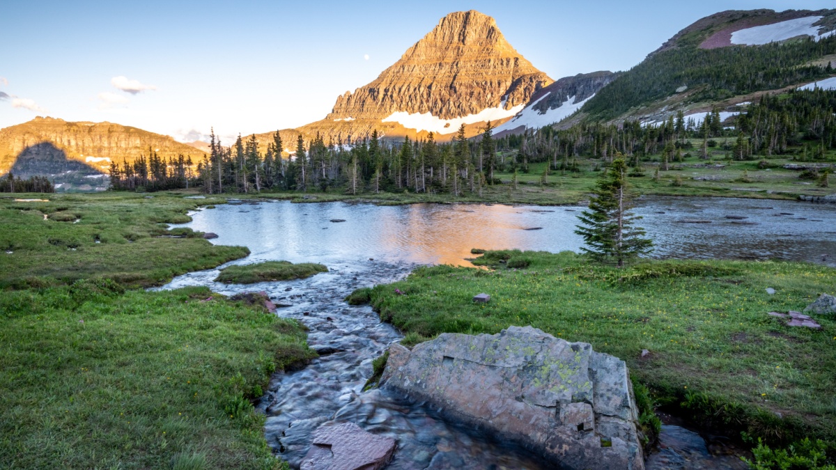
Image Credit: Kimberly Shavender/Shutterstock.
Logan Pass is unbelievably beautiful all on its own, but it’s also the starting point for two of the park’s most popular hikes, which is why the parking lot sometimes fills so ridiculously early. I’ve found that within an hour or two of sunset, a lot of parking is available, probably because the masses left long before to get dinner and go night-night.
Use the Free Shuttle System

Image Credit: Sundry Photography/Shutterstock.
To avoid the stress of creeping traffic and challenging parking, you can use the park’s free shuttle system. If you have a specific itinerary and timeline, this might work, but if you have all day and just want to see the highlights, this might be perfect for you. It also, with a shuttle vehicle at one end, can facilitate some epic day hikes that start in one place but end in another.
Numa Ridge Lookout
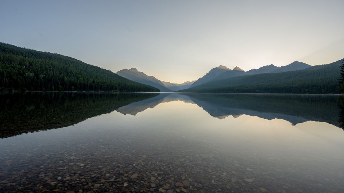
Image Credit: Kelly vanDellen/Shutterstock.
The trail starts from Bowman Lake, which is a pretty long drive on unpaved roads in the North Fork area of the park. Ultimately, this moderately long and steep day hike ends at a fire lookout on Numa Ridge. Because of the drive and the hike, this place never gets mobbed, and there are great views.
Lake McDonald
Image Credit: Morgan Purcell/Shutterstock.
On the west side of the park, Lake McDonald is the first lake you reach, and it’s the largest, longest, and deepest lake in Glacier. It’s also one of the most-visited. If the rocky beach at Apgar and the many GTTSR pullouts are taken up, try an unpaved road near McDonald Falls that leads past a ranger station to a short stretch along the northwestern corner of the lake.
Mt. Oberlin
Image Credit: Kelly vanDellen/Shutterstock.
If you manage to find a parking spot at Logan Pass and have hiked the Hidden Lake Trail or the Highline Trail and want something different, look for a trail heading toward Mt. Oberlin. The lowest peak in the vicinity, Oberlin might not seem like much, but its summit has great views, and it’s the easiest peak to climb in Glacier. Most of the route up it is easy but steep, but there are sections that get a little spicy and require some scrambling and route-finding skills. You probably will see other groups here, but they’ll number in the few as opposed to the dozens or hundreds on those popular trails taking off from Logan Pass.
Lunch Creek
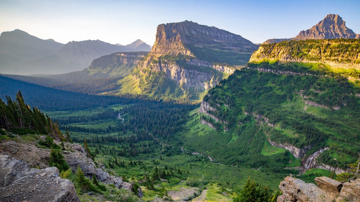
Image Credit: JMY Photography/Shutterstock.
The small parking area is like a mile or so east and downhill from Logan Pass, and drivers frequently use it for parking when Logan Pass is full. If you can park here, cross the road (carefully, since it’s on a curve) and follow informal trails along Lunch Creek past several pretty cascades to an impressive waterfall.
Siyeh Pass Loop
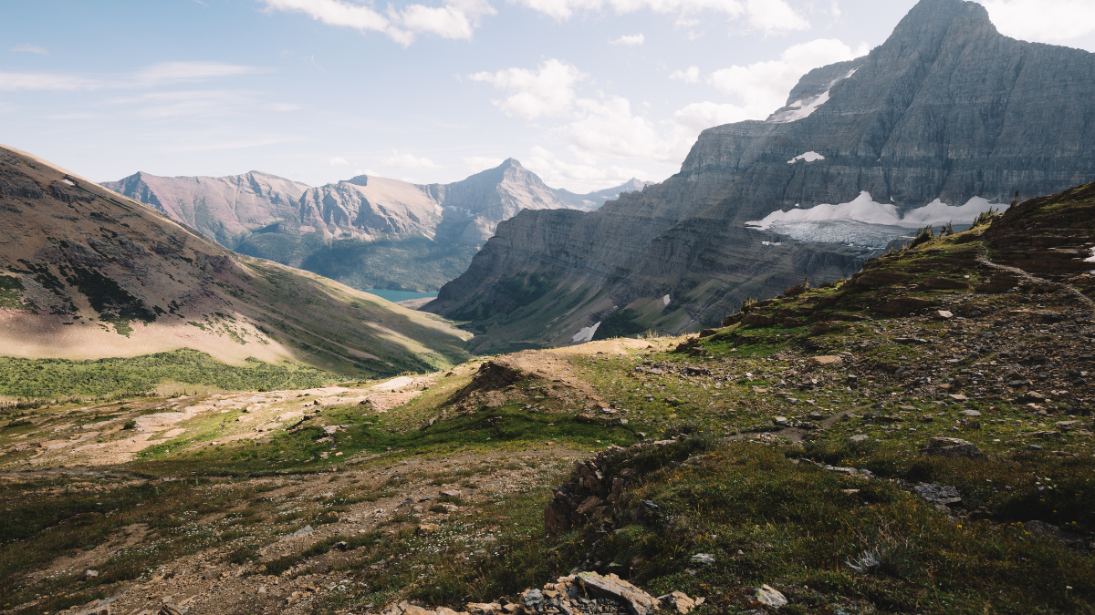
Image Credit: Aaron M. Street/Shutterstock.
The shuttle system is the best way for this unless you have two cars. Get out at Siyeh Bend and hike the trail up into some admittedly boring forest. You’ll reach a trail junction where you can continue left to Piegan Pass or right to Siyeh Pass; go right. You’ll soon reach Preston Park and its lovely meadows, and then the trail will steeply climb to Siyeh Pass, the highest trail-accessible pass in the park. Views are spectacular. From the pass, the trail descends steeply, with unbeatable views of mountains and glaciers, and it ultimately goes through Sunrift Gorge, where a rushing stream crashes through narrow red walls and over a red streambed. This loop is popular, but it’s not crowded since it’s simply too long and strenuous for most people.
Cracker Lake
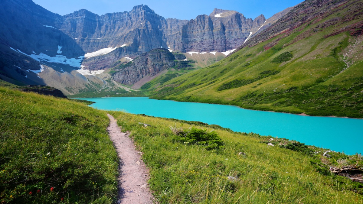
Image Credit: Steve Boice/Shutterstock.
Fed by the meltwater and silt from a fading glacier, Cracker Lake is, at least for now, an amazingly colored lake in the Many Glacier area. Despite its beauty, it doesn’t get the visitation you might expect. The one-way distance is 6.5 miles, so most people going there are hardy day hikers, backpackers, or horse riders; all told, they don’t come close to the trail traffic on the other popular hikes in this area.
Redrock Falls
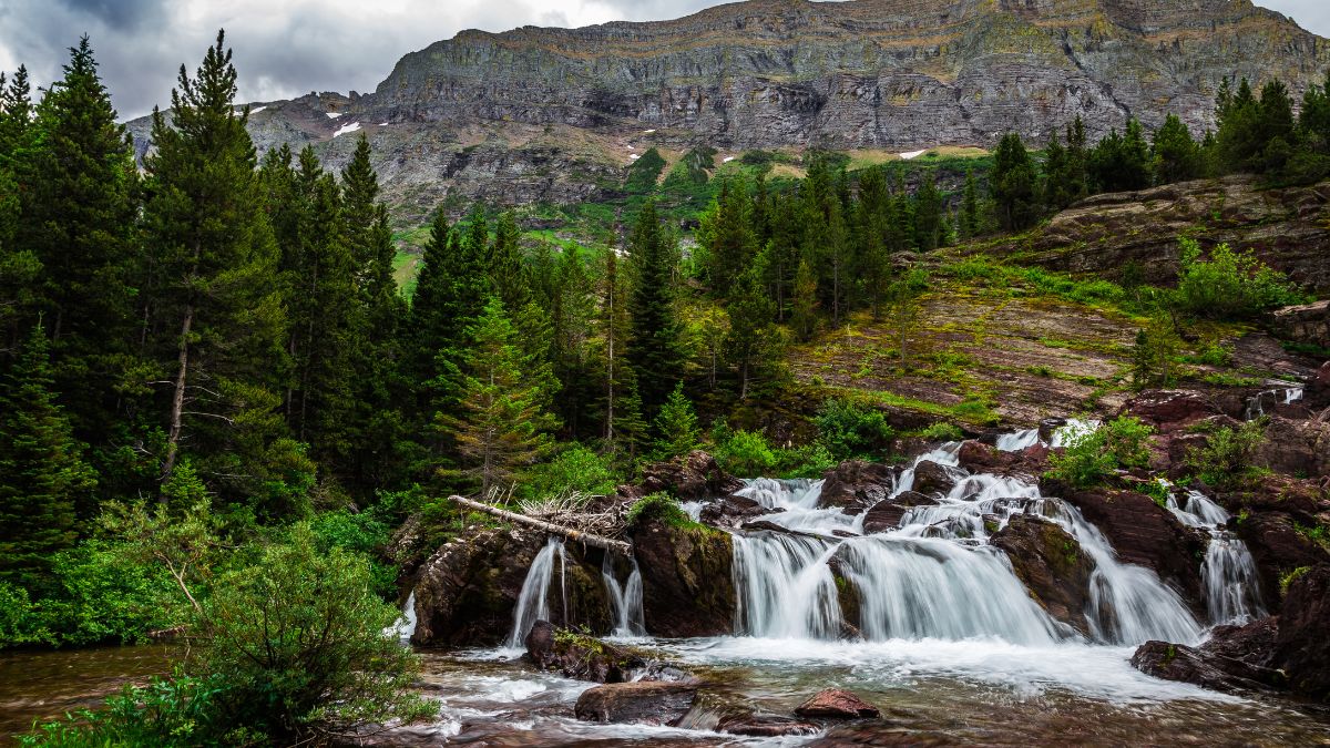
Image Credit: Beach Creatives/Shutterstock.
Located in Many Glacier, Redrock Falls is a short, easy hike. This well-named waterfall is popular, but it gets a fraction of the traffic nearby trails such as Iceberg Lake and Grinnell Glacier get. Frequently, there are moose at Redcap Lake along the way.
Cut Bank
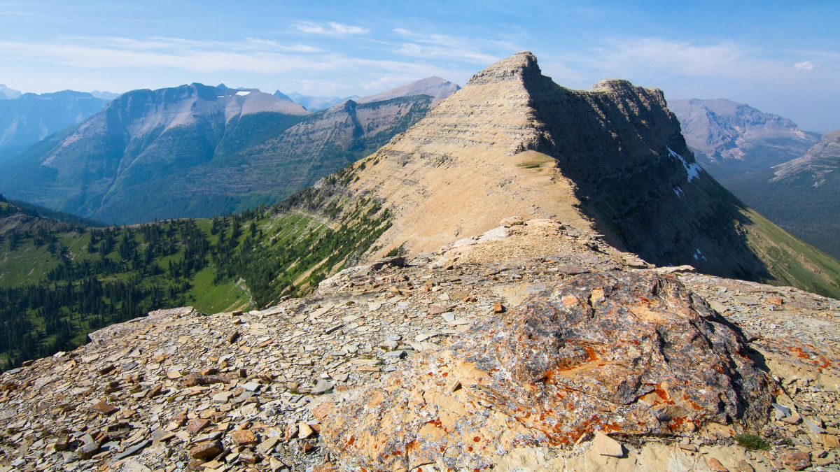
Image Credit: Kevin Wells Photography/Shutterstock.
The Cut Bank area has a small campground and tiny trailhead parking area, so this place is never jammed. Good destinations for day hikes from here include Morning Star Lake, Atlantic Falls, Medicine Grizzly Lake, and Triple Divide Pass.
Scenic Point

Image Credit: Robert Harding Video/Shutterstock.
The hike to this feature in the Two Medicine area is just 3 miles, but with an elevation gain of over 2,200’, it’s quite steep, so this trail, while well-used, rarely feels busy. Views from the top are spectacular and may inspire some future exploration.
Pitamakan-Dawson Loop

Image Credit: Robert Sihler.
This epic 18-mile hike starting and ending at Two Medicine Lake is one of the best in all the national parks. It passes mountain lakes and crosses two high mountain passes on the Continental Divide. There are also two backcountry campgrounds off the loop in case you want to split this up over one or two nights. Since these two sites are in high demand, most people do the loop as a day hike, and the length and difficulty mean that up high, there’s not that much traffic despite the stellar scenery.
Firebrand Pass

Image Credit: Tony Tomassi/Shutterstock.
The parking area for this hike in southern Glacier is off U.S. 2, not far west of East Glacier Park. It’s about 4.5 miles to this pass that has good views of lesser-known parts of the park. While this hike is no secret, it’s pretty far out of the way of the busiest parts of Glacier, so even when it’s “busy,” it isn’t crowded.

Leave a Reply