
It’s easy but misguided to think of popular, well-known hikes as being safe due to their usage and familiarity.
All kinds of things can go wrong in the great outdoors, and quickly. In fact, some of the most iconic hikes in the United States have elements of risk to them that partially define their iconic status. Before you go out on any of the hikes that follow, make sure you know the risks and that you’re prepared for them.
Mt. Whitney Trail, California
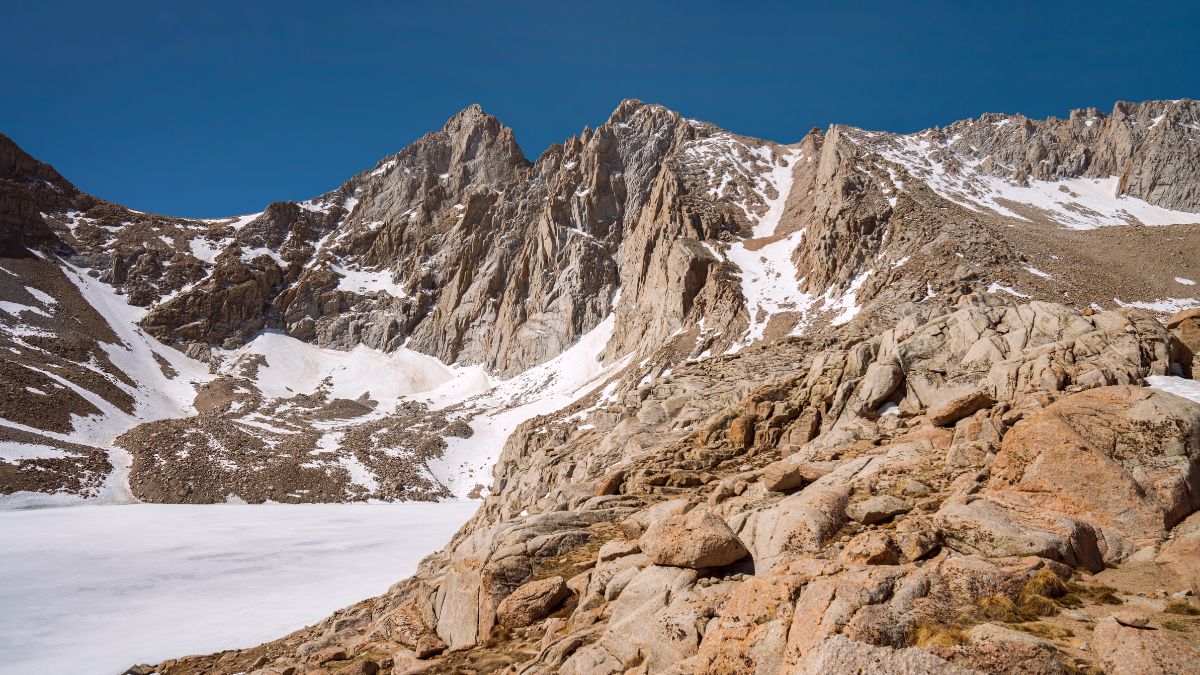
Image Credit: Conrad2x/Shutterstock.
Mt. Whitney in Sequoia National Park is the highest peak in the Lower 48 at 14,494’. Most people who reach its summit start from the Whitney Portal on the eastern side of the Sierra Nevada near Lone Pine. This trail is 12 miles each way, and the elevation gain is nearly 6,000’, making this one of the longest and most strenuous day hikes in the country. Risk factors include heat exhaustion, exposure to sudden storms, dehydration, and altitude sickness.
Mesquite Flat Sand Dunes, California
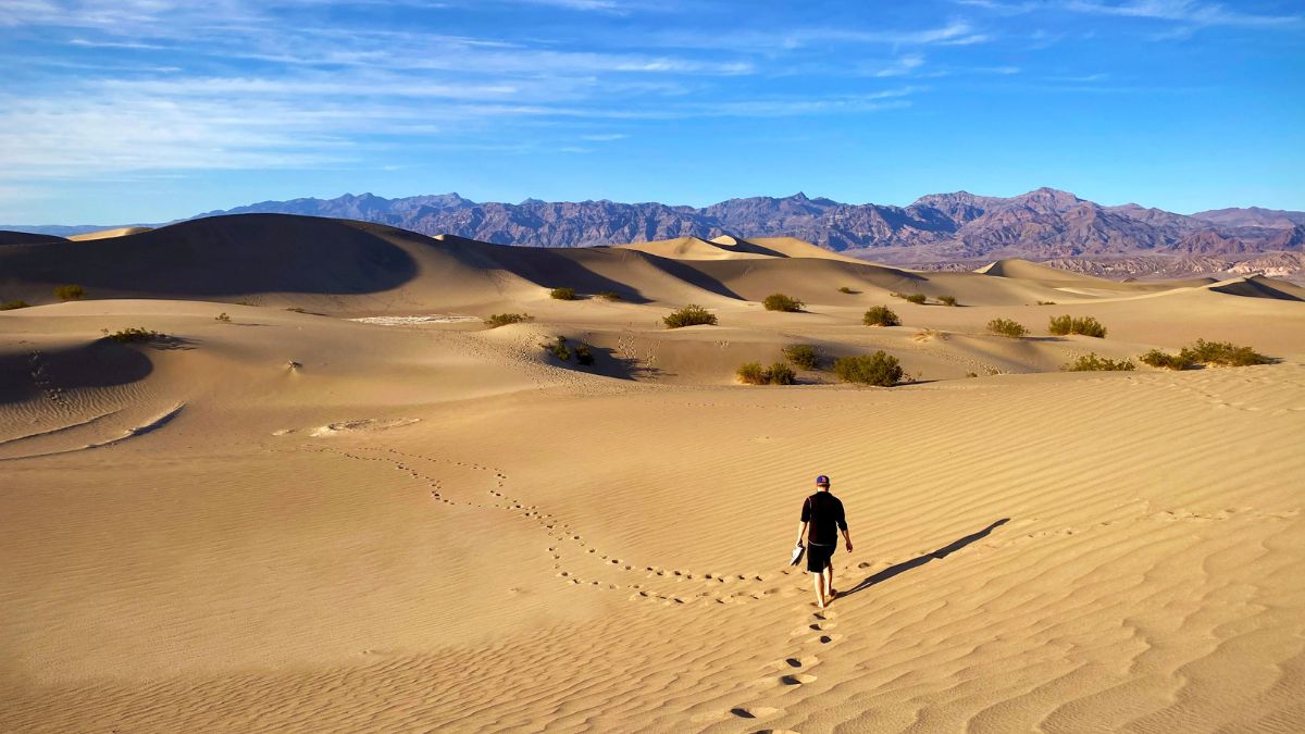
Image Credit: danesprintshop/Shutterstock.
These famous sand dunes in Death Valley National Park have been featured in many movies, including the original Star Wars film. These dunes aren’t that terribly high, so wearing yourself out isn’t much of a concern. The real concern is the heat. Air temperatures here can reach 130 F, and surface temperatures get even higher. People have died here from heat exhaustion, heatstroke, and dehydration even on short hikes.
Iceberg Lake Trail, Montana
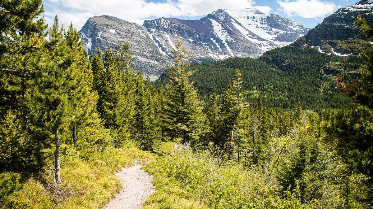
Image Credit: Wichakorn Kitrungrot/Shutterstock.
This trail is one of Glacier National Park’s most scenic trails, and its namesake destination is one of the park’s crown jewels. Sudden changes in weather can pose risks, but the biggest risk factor here is grizzly bears. There are more grizzly sightings along this trail than along any other trail in the park, and if you don’t know how to act in bear country, you could end up being a news item.
Ptarmigan Wall Goat Trail, Montana
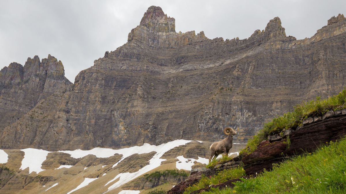
Image Credit: Anh Luu/Shutterstock.
As you hike the last stretch to Iceberg Lake, you’ll admire a high, sheer mountain wall on your right. This is the Ptarmigan Wall, and what almost no one knows is that on the back side of it is a trail hugging sheer cliffs for about six miles, and it was made by mountain goats.
Getting to the goat trail is complicated and dangerous and has claimed people’s lives, and the trail itself is even scarier. There’s no scrambling or climbing involved, but in places, the trail is less than two feet wide; on one side is a sheer mountain wall, and on the other side is an unbroken drop of hundreds of feet.
This is no place for anyone afraid of heights or exposure, and it’s no place to be caught in bad weather (which once happened to me, and it was terrifying).
Upper Geyser Basin, Wyoming
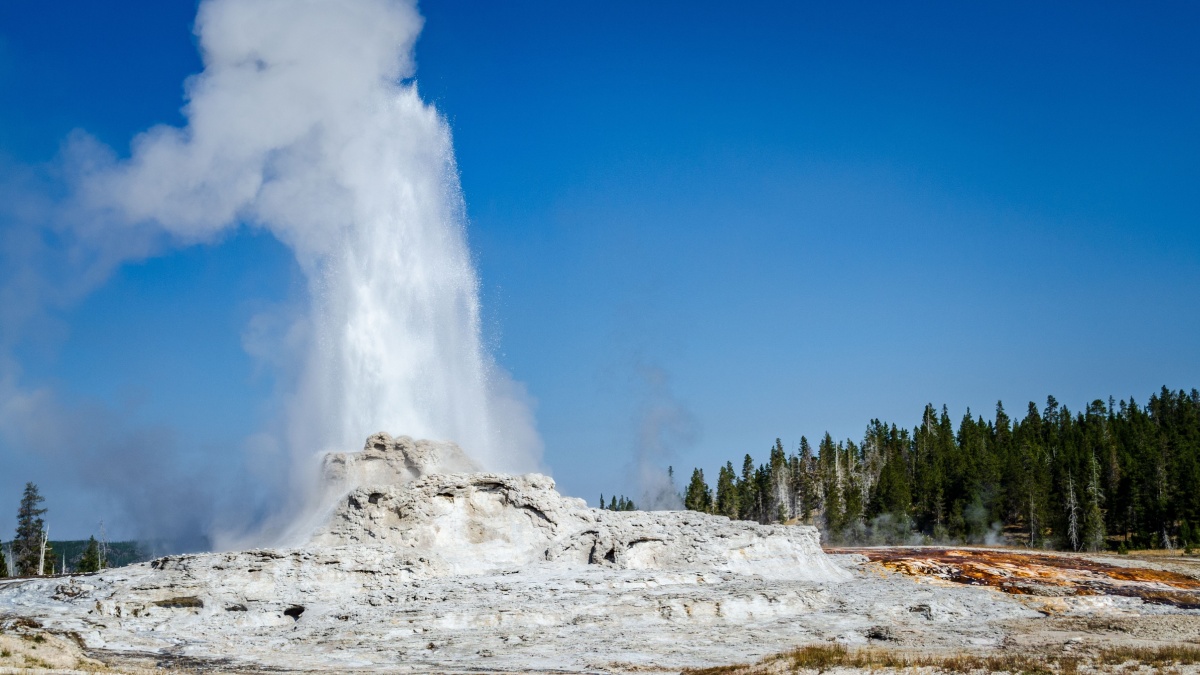
Image Credit: Zack Frank/Shutterstock.
The risk factors associated with this location in Yellowstone National Park apply to all geothermal areas in Yellowstone and anywhere else. Stay on the trail! The crust is thin and weak in a lot of places here, and people have broken through into scalding water that has caused severe burns and several deaths.
Cascade-Paintbrush Loop, Wyoming

Image Credit: Richard Westlund/Shutterstock.
This full loop ascends up one canyon, over a high mountain pass, and then down another canyon in Grand Teton National Park. During this route, you’ll pass through some of the best scenery in the park that you can see by trail.
The full loop is 23 miles, and you can shave up to four miles from it by using a boat shuttle across Jenny Lake. Bad weather, dehydration, sun exposure, fatigue, and altitude sickness are risks here, but this hike comes with a special one.
There’s usually an ice axe advisory until at least mid-July for safely navigating Paintbrush Divide, so when that’s the case, you should have an ice axe and know how to use it for both ascending and descending steep, sometimes icy snow.
Longs Peak Keyhole Route, Colorado

Image Credit:David Spates/Shutterstock.
This is the most popular route up Longs Peak, the highest and most dominant peak in Rocky Mountain National Park. It’s 8 miles to the summit, with 6000’ of elevation gain and sections of scrambling and potentially deadly exposure.
Because you’re going to a 14,255’ summit, you have the typical alpine concerns of altitude sickness, dehydration, and sun exposure.
In addition, summer weather in the Colorado mountains is more unstable than that in the Sierra Nevada, and seasoned veterans of these peaks know to expect thunderstorms anytime after 10 A.M. Many people have found themselves in serious trouble by starting too late and getting caught in an electrical storm high above timberline.
Flattop Mountain Trail, Colorado
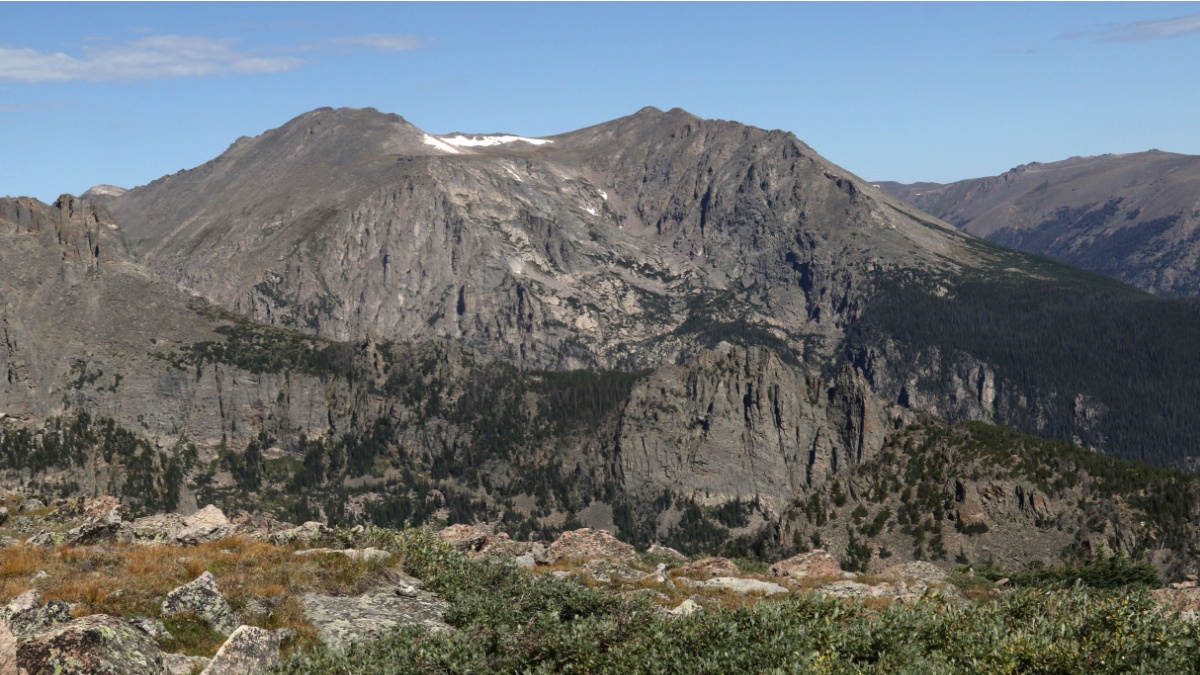
Image Credit: vagabond54/Shutterstock.
Longs Peak is too much for some people, and for those wise enough to acknowledge it, there’s Flattop Mountain, also in RMNP, as a good alternative. It’s an alpine peak as well, but it’s lower, and it’s all hiking on a well-maintained trail. The trail is also shorter and not as steep. However, since it’s still an alpine peak, you still have most of the same risk factors here as you do on Longs Peak.
Angels Landing, Utah
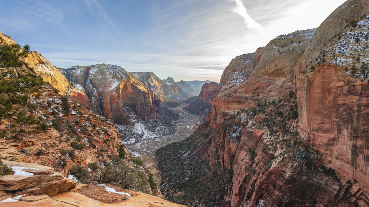
Image Credit: imageBROKER.com/Shutterstock.
This popular trail in Zion National Park isn’t terribly long, but it’s quite steep, and people often do this hike without adequate footwear or enough water. The final stretch to a summit with excellent views up and down Zion Canyon is so narrow and exposed that there are guardrails and chains for people to grab as they go. Nevertheless, people have fallen to their deaths here.
Virgin River Narrows, Utah
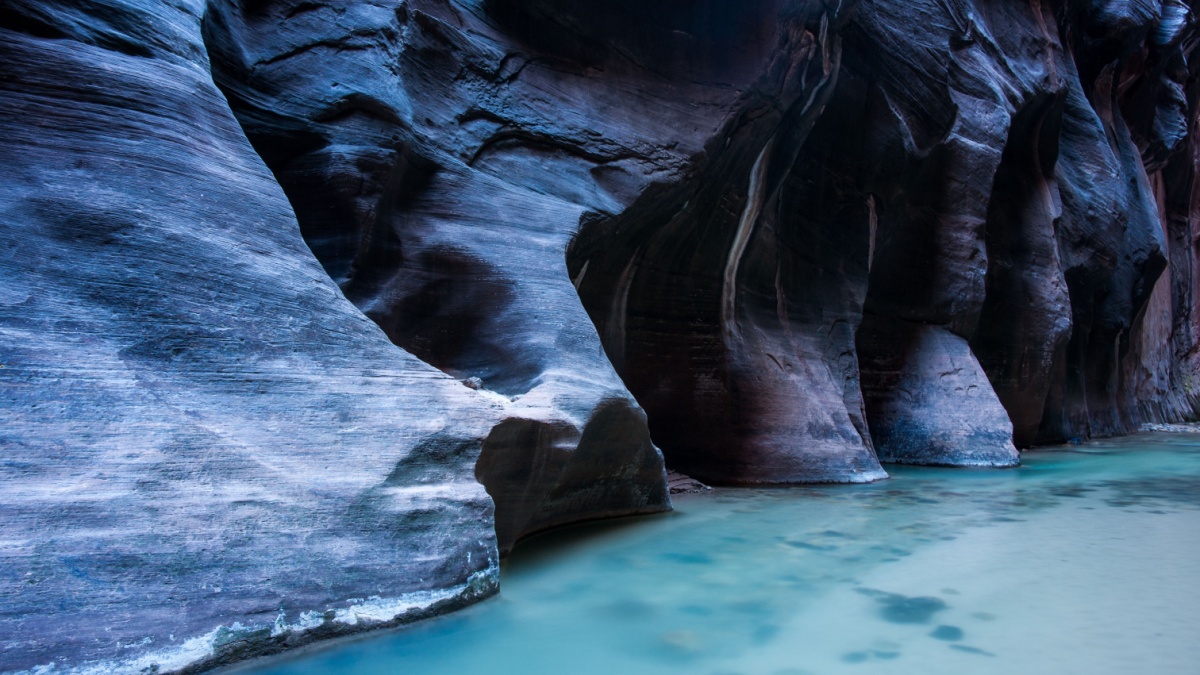
Image Credit:Andrzej bronek Waligora/Shutterstock.
Another Zion classic, the Narrows is a journey where the river itself is the “trail. Water levels are lowest in summer and early fall, which is when most people embark upon this adventure, but even summer isn’t necessarily safe.
Hypothermia is a risk if you start out early, you may have to swim or wade in deep areas where currents are strong, and flash flooding can turn you into a statistic. Never head in if forecasts suggest storms higher up and farther away; a lot of that rainfall finds its way to the Virgin River, and you could, on a calm summer day, see a wall of water rushing at you when you have nowhere to go.
Buckskin Gulch, Utah
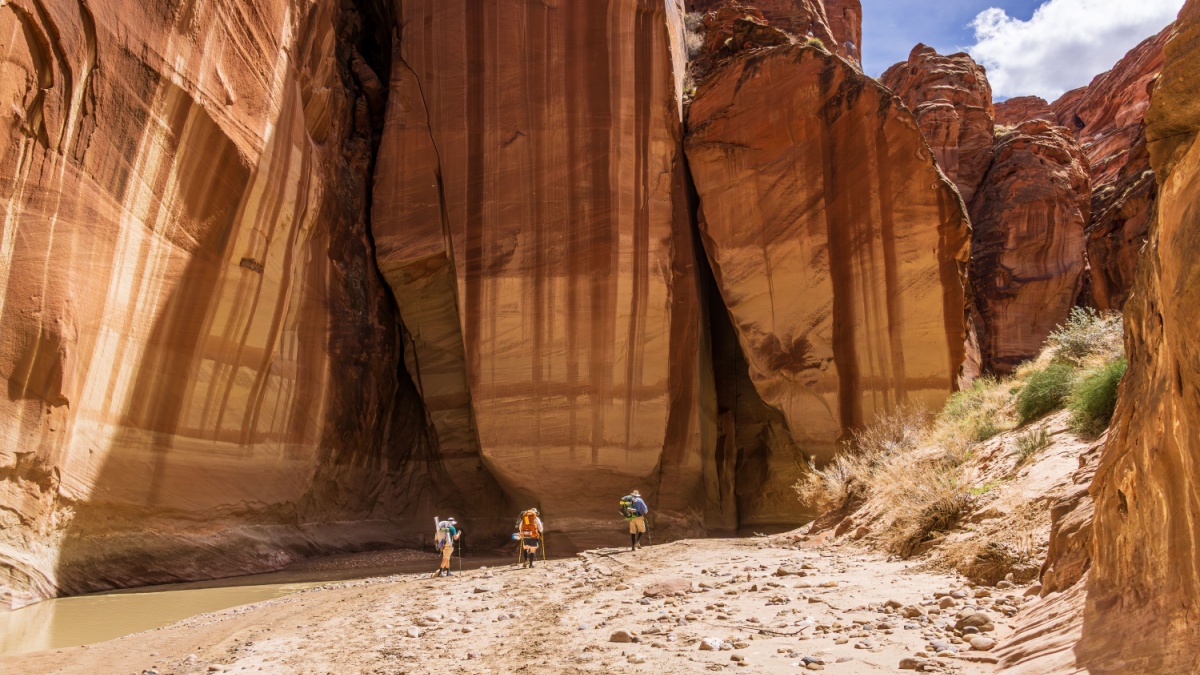
Image Credit: feel4nature/Shutterstock.
Buckskin Gulch is one of the longest and narrowest slot canyons in the world. In some places, many people can stretch their arms out and touch both sides of the canyon at once. Flash flooding is the chief danger here.
Don’t go in if the forecast suggests rain, and if you’re inside already and a storm rolls in, find the highest ground you can, or, if you’re close enough, get back out the way you went in.
South Kaibab and Bright Angel Trails, Arizona
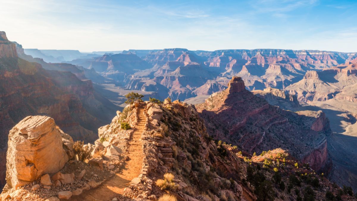
Image Credit: Andrew Tufenkian/Shutterstock.
These two trails combine as a popular way to visit the bottom of the canyon from the South Rim. Since the South Kaibab Trail is shorter and steeper, many people use it for the descent and the Bright Angel Trail for the return hike.
Plus, the latter has water and shade at Indian Gardens about halfway along. The chief danger of this hike is the heat, as the canyon bottom is typically 20 degrees or more hotter than the rim temperatures are. Park rangers strongly recommend not trying to do the entire hike in a single day from spring through fall.
Huntington Ravine, New Hampshire
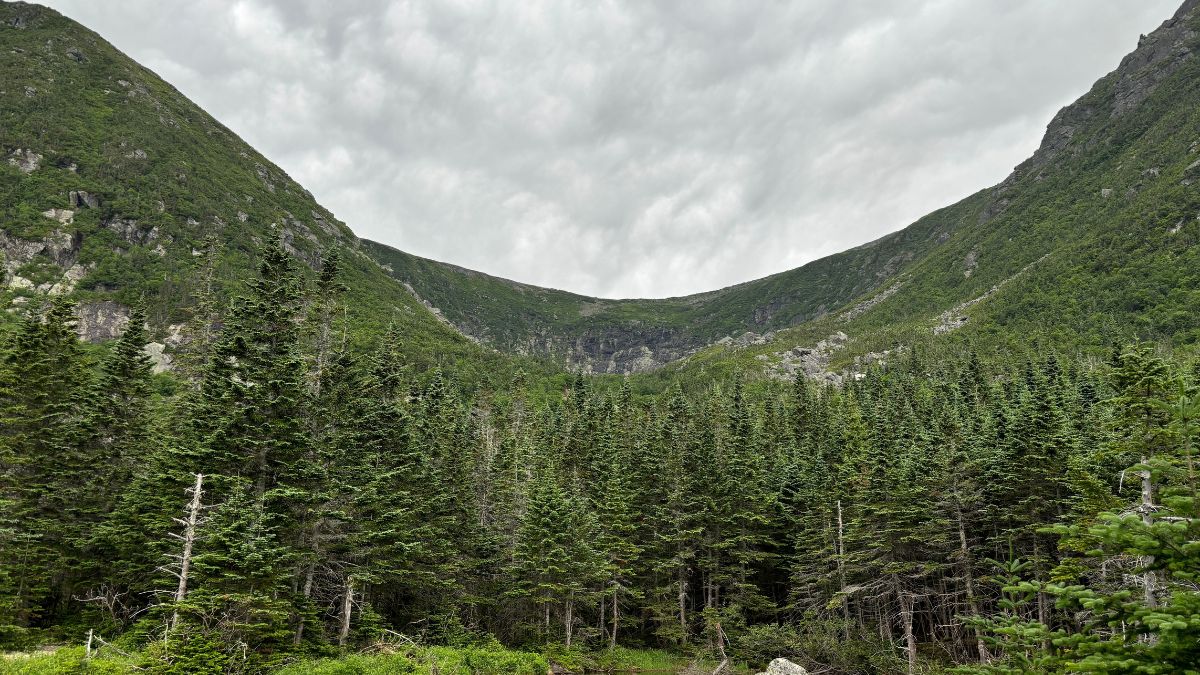
Image Credit: Third Degree Brands/Shutterstock.
Huntington Ravine is the most challenging hiking route that accesses the summit of Mount Washington, the highest peak in New England.
Challenging terrain always poses risks, but the #1 concern is the weather. Mount Washington has some of the worst and most unpredictable weather on the planet, and even on a calm, sunny summer day, things can quickly change to thunder, hail, snow, and raging winds.
Knife Edge, Maine
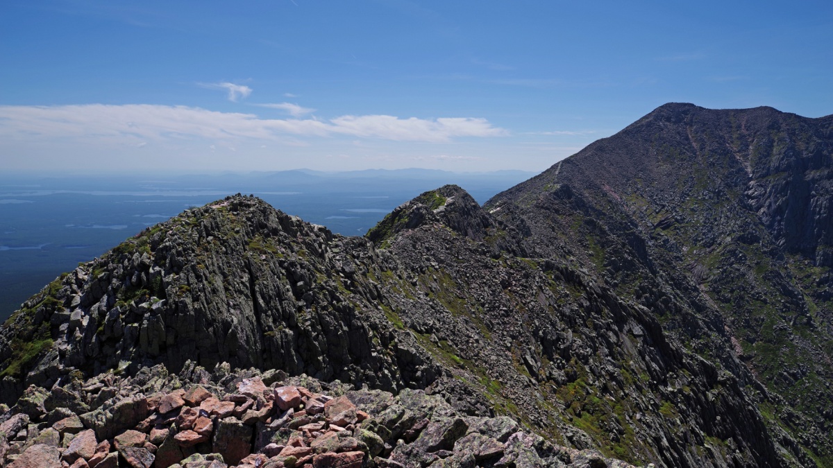
Image Credit: FrankShirley/Shutterstock.
There are three main foot routes to the summit of Baxter Peak, Maine’s highpoint and the northern end of the Appalachian Trail. The Knife Edge is the most adventurous of the three, known for its long, narrow, and exposed ridge that requires some scrambling.
Be prepared for that exposure and for changing weather. The Knife Edge is a bad place to be caught in a storm, and if rain is on the forecast, wait for another day or take the Appalachian Trail to the top.

Leave a Reply