
From Front Royal, Virginia, Skyline Drive winds along the crest and gaps of the Blue Ridge Mountains in Shenandoah National Park for 105 miles. After that, the Blue Ridge Parkway begins, and it climbs, drops, and winds for 470 miles to Cherokee, North Carolina, where the main road through Great Smoky Mountains National Park begins.
In all, the three locations serve up more than 600 unbroken miles of driving through mountain scenery without a single stoplight. There are also enough gas stations, campgrounds and lodges, and supply stores that you never have to leave the parkways if you don’t want to.
So if you’re going to undertake such a long trip, you’re surely going to want some ideas about what to see and do. All of the following suggestions are things that are accessible directly from these roads.
Overall Run Falls (Shenandoah)
This waterfall in the park’s North District is the highest in the park at about 93’. You can reach it via a moderately difficult trail. Like all waterfall trails that depart from Skyline Drive, the return hike is uphill.
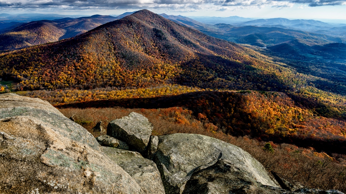
Hawksbill (Shenandoah)
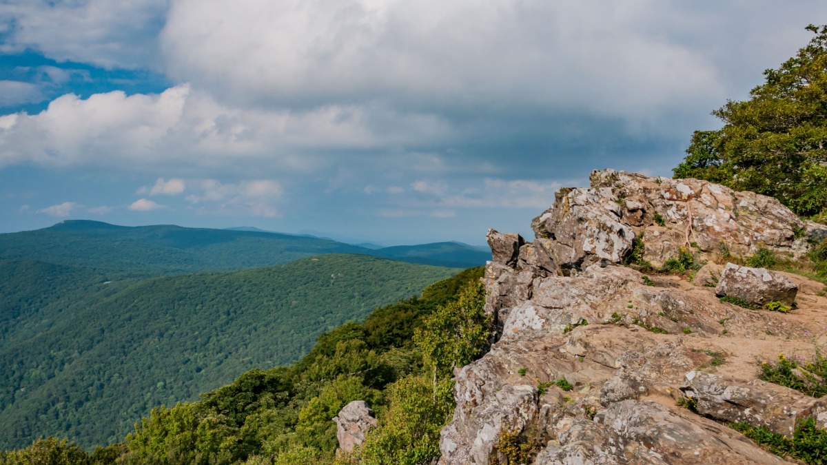
At 4,050’, Hawksbill Mountain is the highest peak in the park. Trails lead to a shelter and a viewing platform at the summit, and there are plenty of rock outcrops to climb around on.
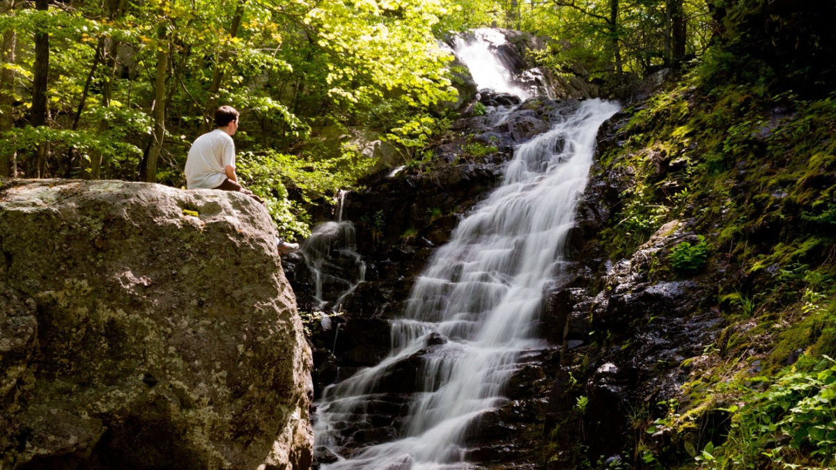
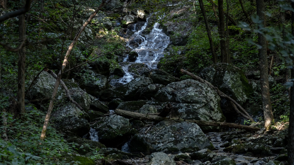
Dark Hollow Falls (Shenandoah)

Dark Hollow Falls, in the park’s Central District, is perhaps the easiest waterfall hike that starts from Skyline Drive. The hike is less than a mile, but you can turn it into a loop with the Rose River Trail and see more waterfalls and mountain streams.
Bearfence Mountain (Shenandoah)
Not too far south from Dark Hollow Falls is a short, popular loop that includes the summit of this peak. The highlights are some sections of rock scrambling and the 360-degree views up top.
Doyles River-Jones Run Loop (Shenandoah)
Of several excellent loop hikes in the South District, this one may be the best. You’ll see a total of three beautiful waterfalls along with several smaller cascades. There’s also a rustic cabin that you can reserve to spend the night in.
Sharp Top (BRP)
For a time, people thought this peak in the Peaks of Otter area was Virginia’s highest because it’s so prominent and pointed. It’s not even the highest in its immediate vicinity, but it’s the most spectacular, and a moderately difficult trail gets you up top for great views.
Linville Falls (BRP)
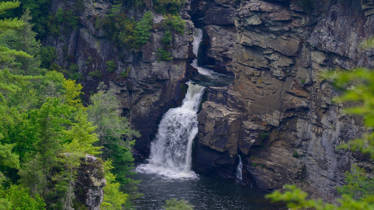
This waterfall along the North Carolina part of the Parkway is one of the most spectacular in the East due to its force and volume. There are easy trails to overlook, including at the very brink, but the best way to appreciate this waterfall is to do the steep hike down into Plunge Basin at the very base of the falls.
Mount Mitchell State Park (BRP)
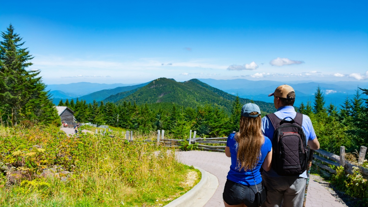
Mount Mitchell in the Black Mountains is North Carolina’s highest peak and also the highest peak east of the Mississippi River. The state park is not part of the Blue Ridge Parkway, but the only vehicle access to it is via a road that leaves from the Parkway.
Craggy Gardens (BRP)
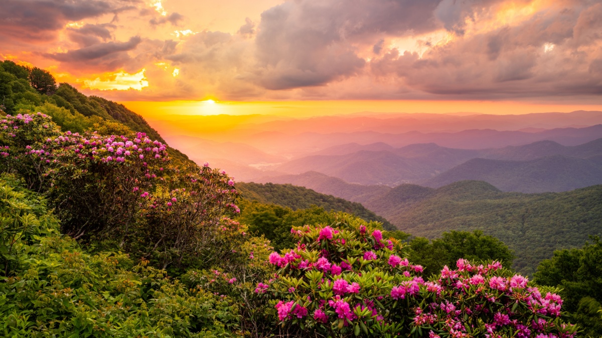
Views are always great here, but the best time to go is in late May. That’s when there are gorgeous blooms of azaleas and rhododendrons all around.
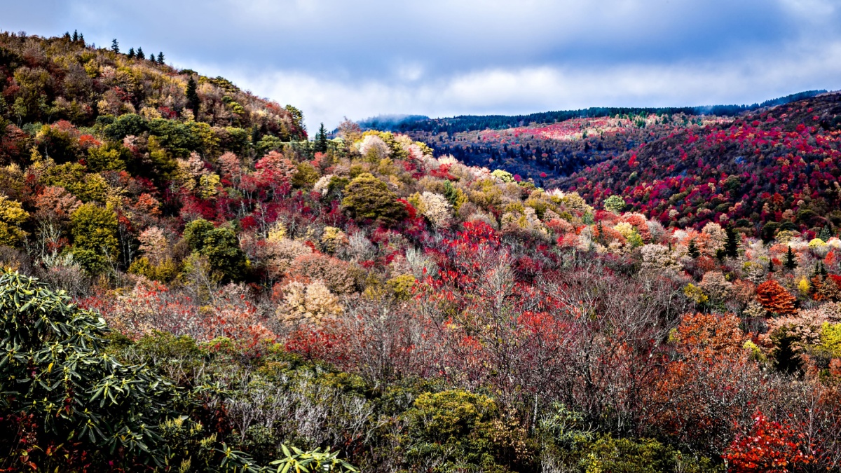
After Asheville, the Parkway has a more remote, wilder feel. Graveyard Fields is unique in the region because it is wide open. Powerful winds knocked down trees here hundreds of years ago, and people thought the stumps resembled gravestones.
Two fires in the 20th century then caused enough damage to the soil to make the regrowth process very slow, and so we have the landscape visible there today. A loop trail through the area takes you to two waterfalls.
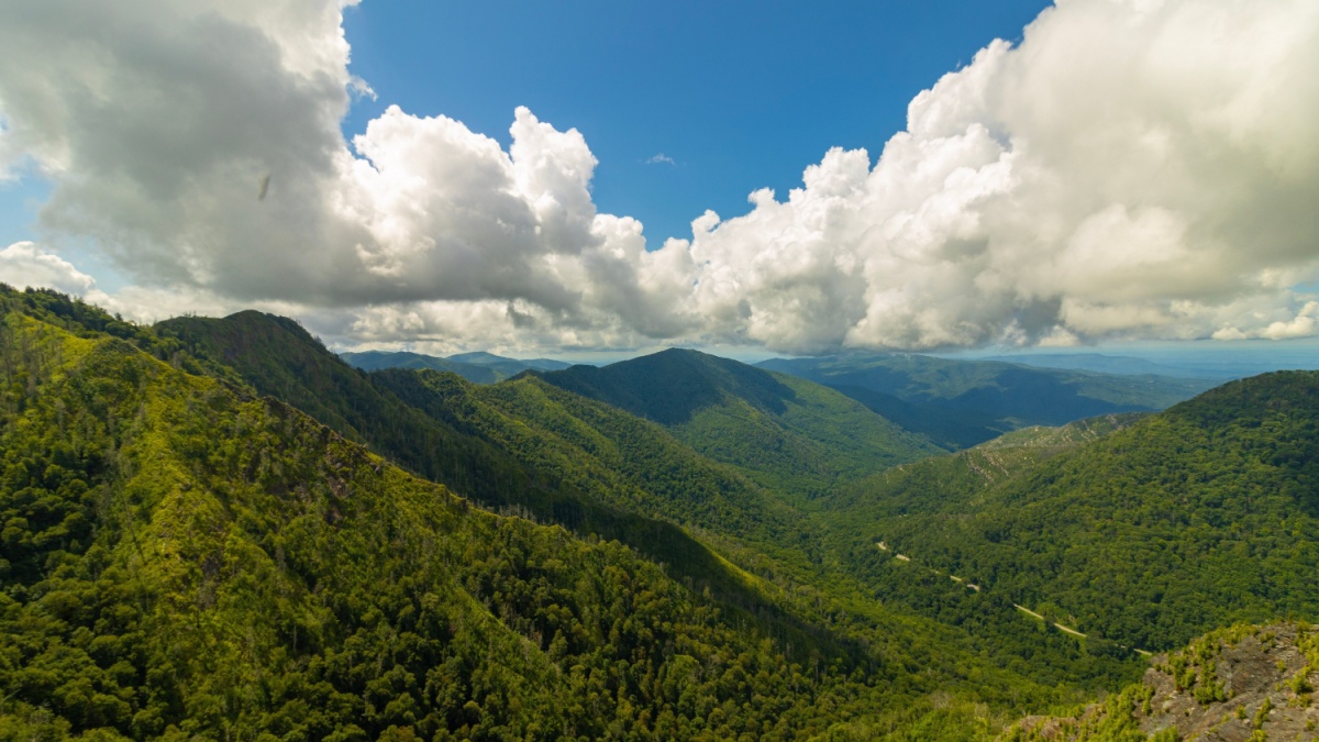
Newfound Gap to Icewater Spring (Smokies)

Newfound Gap is on the crest of the Smokies along the NC-TN border. From there, you can hike the legendary Appalachian Trail for a few mostly easy miles to Icewater Spring, enjoying nice views of the mountains and valleys. There’s a shelter there that you can spend the night in if you get a permit.
Clingmans Dome (Smokies)
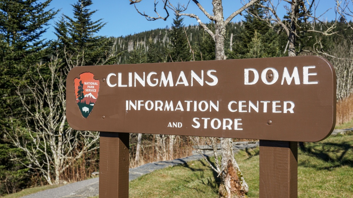
The spur road to Clingmans Dome, the highpoint of the park and Tennessee as well, takes off from Newfound Gap. It’s an easy walk from the parking lot to a viewing tower. You should always expect it to be busy here, but if you want some solitude, you can find it by picking up the Appalachian Trail and heading west on it.
Alum Cave Trail
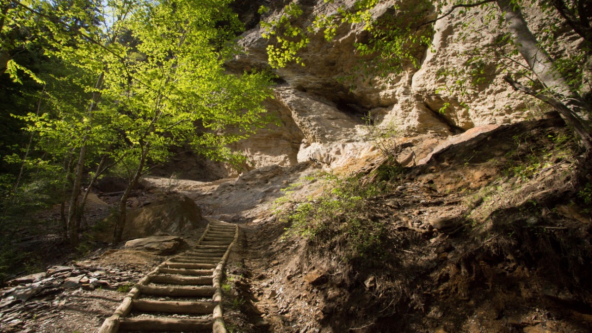
As you descend Newfound Gap Road on the Tennessee side of the park, you’ll pass the trailhead for this hike on your right. It’s only a little under 2.5 miles to the destination, but it’s pretty steep. Views are great, there are some really interesting rock formations, and there is the option of doubling the length and difficulty by continuing to the summit of Mount LeConte, one of the highest peaks in the park.
Chimney Tops
You can’t miss the Chimney Tops as you continue descending Newfound Gap Road. A moderately difficult trail leads to the top of the first one, and then you can do a fairly easy traverse and scramble to the summit of the other.
Laurel Falls

Just a little before Newfound Gap Road exits the park, the Little River Road departs on the left. The namesake stream is beautiful, with several cascades, rapids, and pools, and it leads to a popular area called Cades Cove. Not too far along the road, though, is the trail to Laurel Falls, perhaps the shortest and easiest waterfall hike in the park.
America’s 20 Most Epic Hiking Trails
A country as large and as beautiful as America is lucky to have a huge diversity of hiking trails through many different landscapes of all kinds of lengths and difficulty levels. Here, we’re looking at some of the most epic of them, based on a combination of length and great scenery (so this is not just a list of the longest).
Some can be done in a day, but others are best done over at least two or three days. Several can take weeks or months if you’re going to do them all in one go.

Leave a Reply