
Any Epic Summer Road Trip in Utah Should Include All of the Following Places Utah is one of the most spectacular states in the country.
In fact, many argue that if it only had ocean coastline in addition to all its mountain and desert landscapes, it would be the most spectacular. (It does have the Great Salt Lake, but it’s just not the same.)
Unless you’re a hopeless ski bum, summer is the best time to visit Utah since everything is open, so here’s a suggested tour for seeing the best of the state.
It starts in Salt Lake City, and even though there are mountains in its backyard, we’re saving them for last so your lungs have plenty of time to adjust!
Great Salt Lake
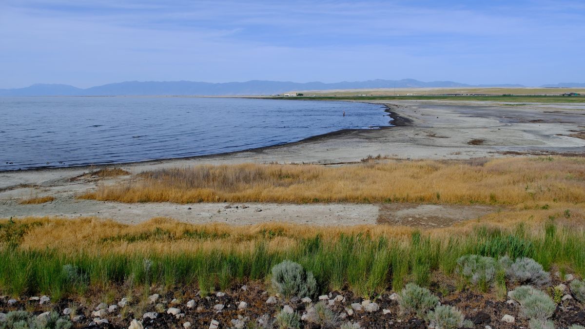
Image Credit: Robert Way/Shutterstock.
Some of the best places to access this famous inland sea are Antelope Island State Park and Great Salt Lake State Park. The lake is really shallow for the most part, and you can wade in really far. Just be aware that it’s a lot saltier than the sea is, so any part of you that stays in contact with the water for long will look ashen and dried out. Bring some replenishing lotions or oils!
Mt. Nebo Scenic Byway
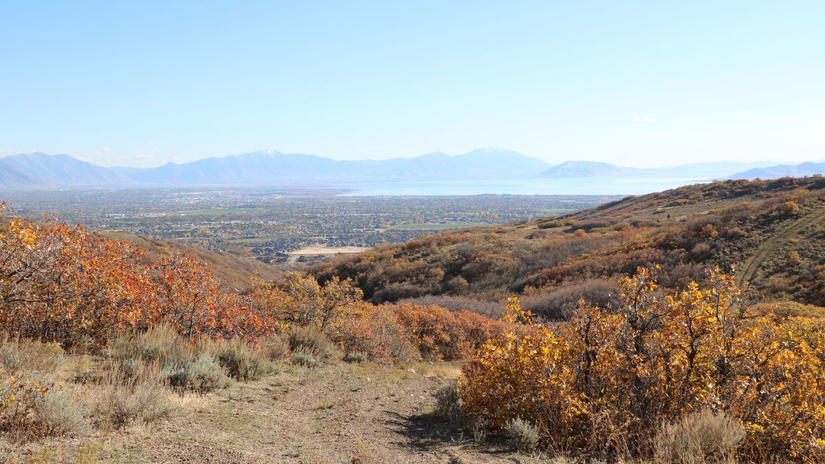
Image Credit: salilbhatt/Shutterstock.
Going south from SLC on I-15, you’ll access the northern end of this byway from Payson. It has great views of Mt. Nebo, the highest peak in the Wasatch Range, but the road itself doesn’t climb high enough for altitude to be an issue for most people. At the byway’s southern end, head west to Nephi and back to I-15.
Zion National Park– Kolob Canyons
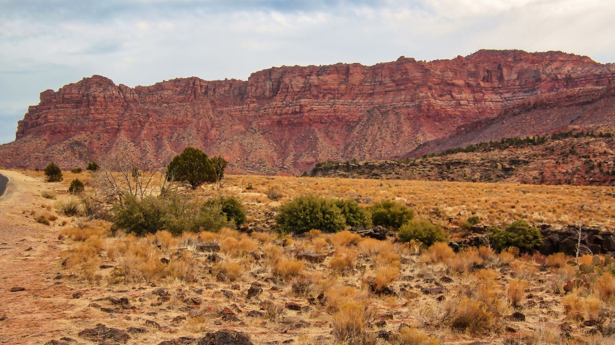
Image Credit: Laima Swanson/Shutterstock.
Continuing south on I-15, look for the exit to this scenic and relatively lightly visited section of Zion. There are trails along the way up the road, which ends at an elevated point with great views of surrounding red sandstone peaks and cliffs.
Zion– Zion Canyon and the East Side
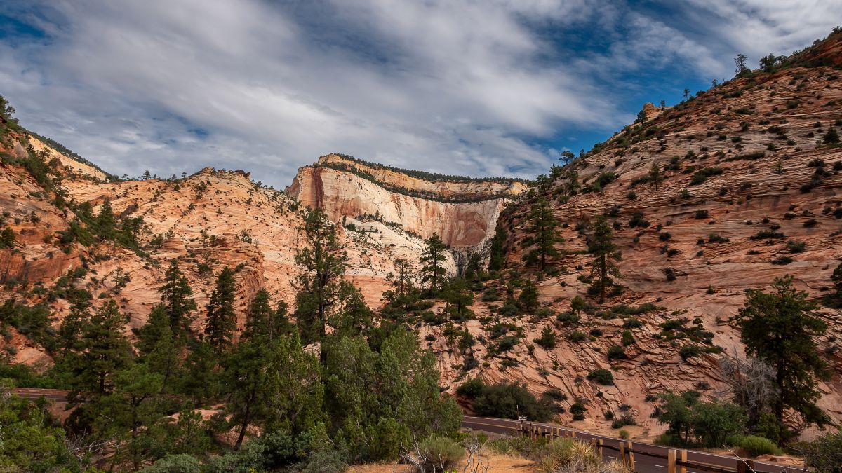
Image Credit: Pete Martin/Shutterstock.
The journey down I-15 finally ends at one of a few exits that will get you to Springdale, which is the gateway town for most people visiting Zion National Park. A free shuttle bus system makes for a stress-free way of seeing Zion Canyon, and when you’re ready to move on, drive up to and through the Zion-Mt. Carmel Tunnel to enjoy the scenic and much less trodden eastern section of the park.
Bryce Canyon National Park

Image Credit:JeMnCk/Shutterstock.
Many trips to Southern Utah link all five of the region’s national parks, and Bryce Canyon, depending on your direction of travel, is either the first after or last before Zion. Regardless, take the detour south from SR 12 to see the multicolored “hoodoos” that make this place so world-famous.
Calf Creek Falls

Image Credit: Andre Luis Michelo/Shutterstock.
Your journey east from Bryce Canyon on SR 12 will take you right past the Calf Creek Recreation Area. If you can find a parking spot, park and get out to hike the mostly easy trail to Lower Calf Creek Falls, a high, beautiful waterfall in an otherwise arid setting of sandstone cliffs and outcrops.
Capitol Reef National Park
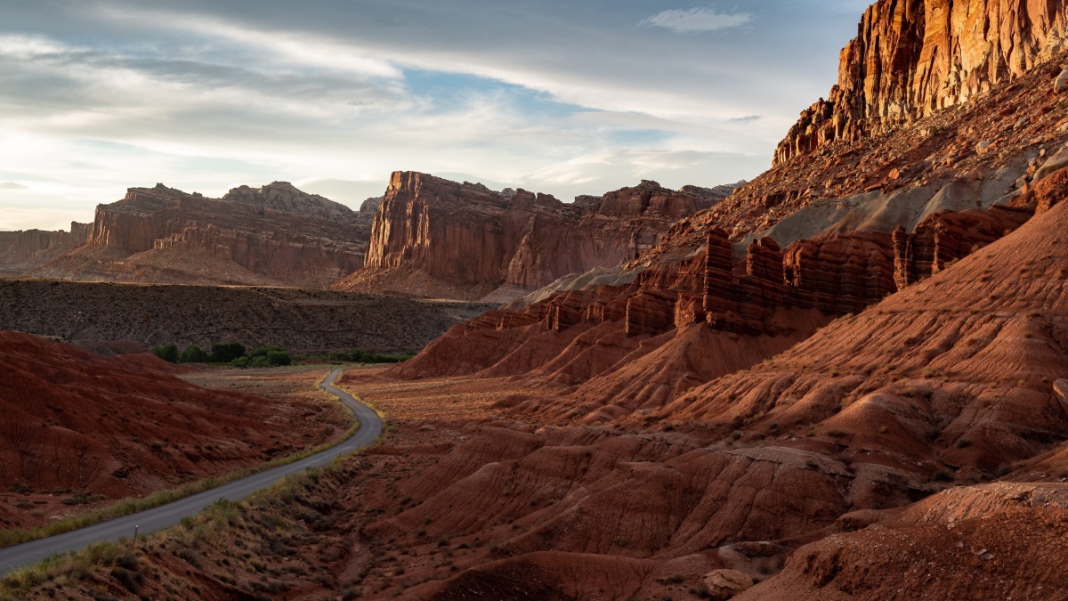
Image Credit:Lars Bentrup/Shutterstock.
When SR 12 ends, you’ll probably turn right (east) onto SR 24. Soon, it enters Capitol Reef National Park. Many people just rush through here on their way to Moab, Arches, and Canyonlands, but spending a little extra time here will be more than worth your while. This national park has a bit of what the other 4 Utah national parks have while also having unique features of its own.
Canyonlands National Park– Island in the Sky
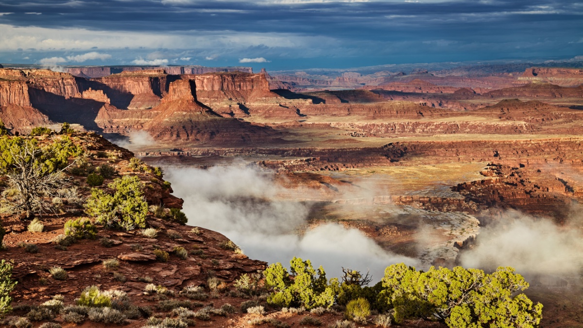
Image Credit:Dmitry Pichugin/Shutterstock.
If you’re doing the Zion-to-Arches thing, the shortest route from Capitol Reef is to head north from Hanksville up to I-70 and then south to Moab via U.S. 191. Along the way, you’ll reach the turnoff to the Island in the Sky District of Canyonlands National Park. It adds a good bit of driving time, but unless you’re exhausted or daylight hours are getting short, you should do this now and save yourself some extra driving later. The views of a natural arch, nearby canyons and desert towers, and distant mountains will be rewarding.
Arches National Park
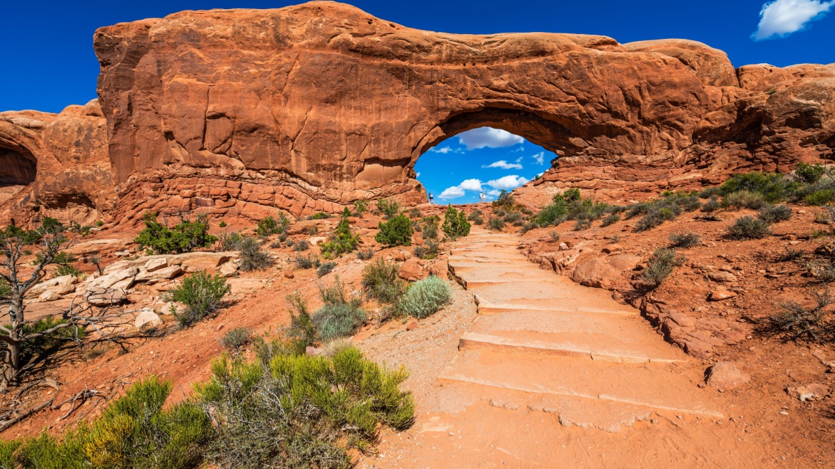
Image Credit:Ondrej Bucek/Shutterstock.
This national park just north of Moab has the highest concentration of natural arches in the world. Plan to spend at least one full day here to see not just many of the arches but also all the spectacular desert towers and cliffs.
Dinosaur National Monument
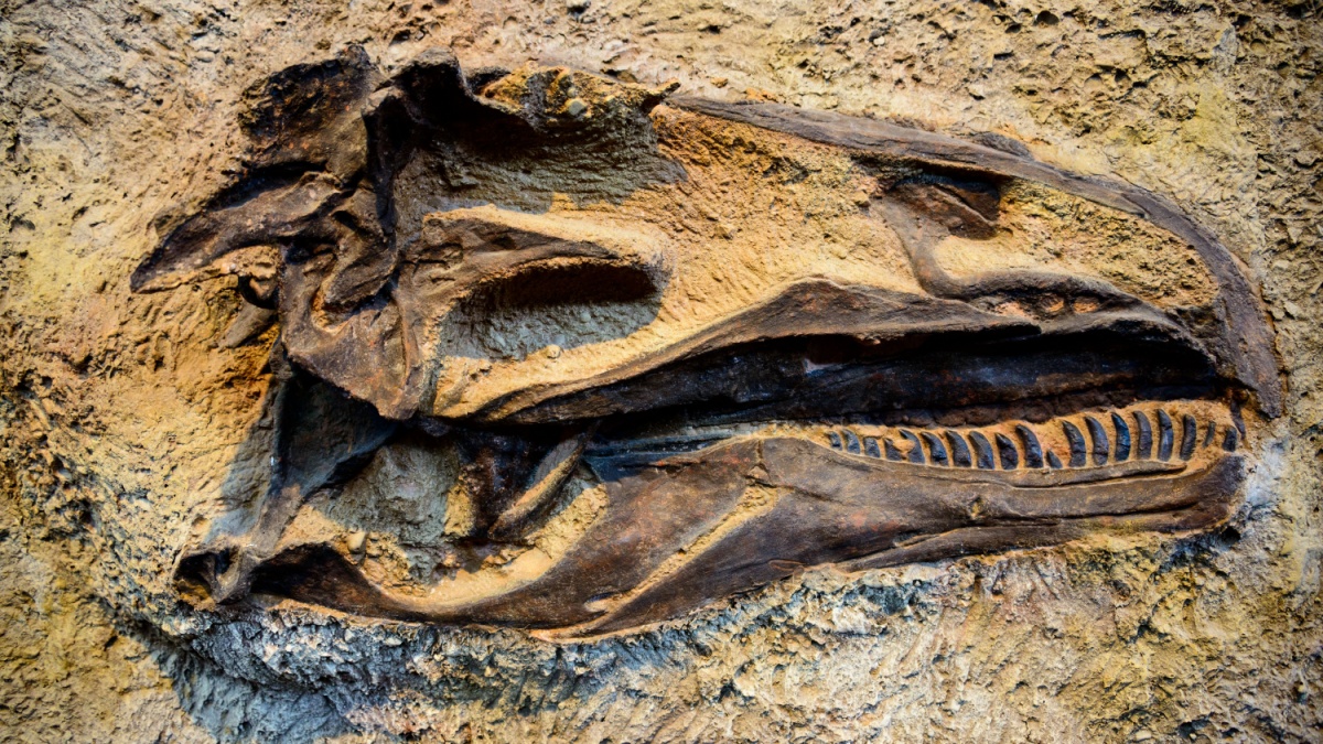
Image Credit: Zack Frank/Shutterstock.
This is a wonderland of cliffs, river canyons, dinosaur bones, and ancient rock art. It’s almost directly north of Moab, but there are no roads directly between them, so this drive could take a full day.
Mirror Lake Scenic Byway
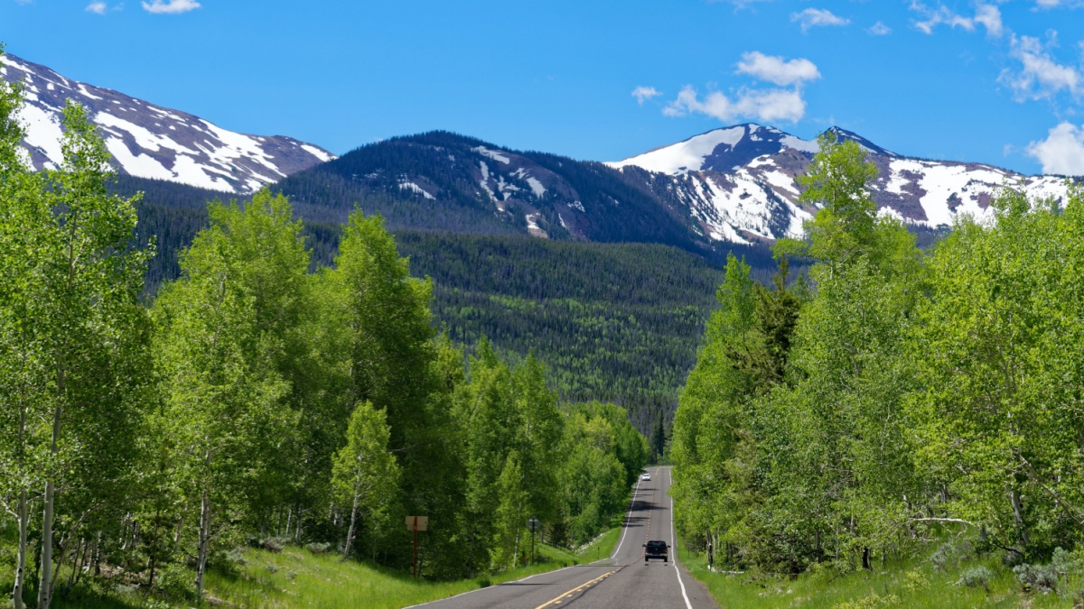
Image Credit: Tristan Brynildsen/Shutterstock.
Get ready for another long day of driving; what could be a 2-hour drive will be around twice that since you’ll have to go south, west, and then northeast to Kamas and the start of this drive. The Uinta Range is the highest in Utah, and this byway climbs high into them, getting you to scenic views, trailheads, waterfalls, and more.
Big Cottonwood Canyon
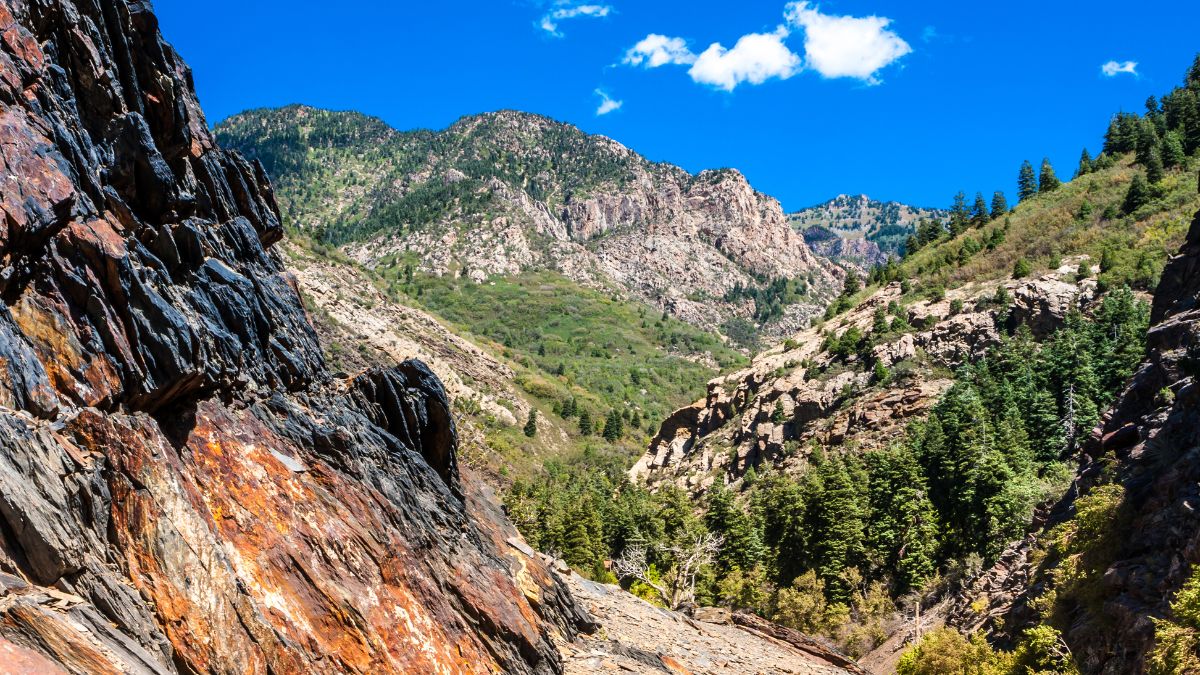
Image Credit: Aneta Waberska/Shutterstock.
Now we’re back in Salt Lake City. East of the city, a road climbs up Big Cottonwood Canyon into the Wasatch Range, eventually reaching the ski resort of Brighton before crossing a pass and dropping into famous Park City. The scenery from the road is great, but there are many trails off it that lead to views and features you’ll never see from the road.
Little Cottonwood Canyon and Albion Basin
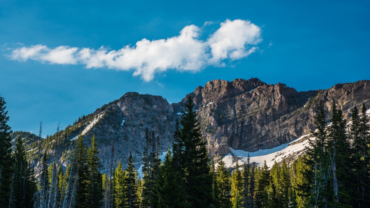
Image Credit: Layne V. Naylor/Shutterstock.
Just south of BCC, LCC is narrower and climbs higher, passing the highly regarded ski resorts Snowbird and Alta. The road ends at Albion Basin, which is at the edge of timberline, is surrounded by mountains, and has some of the best summer wildflower displays in the country.

Leave a Reply